Kunashëvka geodata
Kunashëvka (Chernihiv) is a populated place; located in Ukraine in Europe/Kiev (GMT+3) time zone. With population of 563 people, there are 1612 cities with bigger population in this country. Compared to other cities in Ukraine, 95.7% of cities are located further ↓South; 57.2% of cities are located further →East and 53.4% of cities have higher elevation than Kunashëvka. Note1


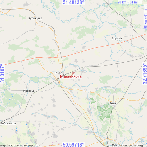
Kunashëvka GPS coordinates[2]
51° 2' 29.004" North, 32° 0' 49.752" East
| Map corner | latitude | longitude |
|---|---|---|
| Upper-left | 51.48138°, | 31.3107° |
| Center: | 51.04139°, | 32.01382° |
| Lower-right: | 50.59718°, | 32.71695° |
| Map W x H: | 98.3×98.3 km | = 61.1×61.1mi |
| max Lat: | 52.18903° ⇑4.3% North |
| Kunashëvka: | 51.04139° |
| min Lat: | ⇓95.7% South 44.39214° |
| min Long | Kunashëvka | max Long |
| 22.20555° | 32.01382° | 40.13222° |
| W 42.8%⇐ | ⇒57.2% E |
Elevation
Elevation of Kunashëvka is 124 m = 407 ft, and this is 31.8 m = 104 ft below average elevation for this country.
| Max E: |
886 m = 2907 ft | 53.4% |
| Avg. | 155.8 m = 511 ft | |
| Kunashëvka | 124 m = 407 ft | |
Min E: |
-3 m = -10 ft | 46.6% |
See also: Ukraine elevation on elevation.city.
Geographical zone
Kunashëvka is located in North temperate zone (between Tropic of Cancer and the Arctic Circle). Distance of this North polar circle is 1725.9 km =1072.4 mi to North.| Distance of | km | miles | from Kunashëvka |
|---|---|---|---|
| North Pole | 4331.8 | 2691.7 | to North |
| Arctic Circle | 1725.9 | 1072.4 | to North |
| Tropic Cancer | 3069.4 | 1907.2 | to South |
| Equator | 5675.3 | 3526.5 | to South |


Nearby cities:
15 places around Kunashëvka: (largest is in red/bold)
• Bakhmach
56 km =34.8 mi,  71°
71°
• Bobrovytsya
54.4 km =33.8 mi,  232°
232°
• Borzna
37.3 km =23.2 mi,  50°
50°
• Druzhba
35.9 km =22.3 mi,  137°
137°
• Ichnya
33.2 km =20.6 mi,  126°
126°
• Kobyzhcha
42.8 km =26.6 mi,  236°
236°
• Kruty
6.8 km =4.2 mi, 72°
• Kulykivka
44.9 km =27.9 mi,  325°
325°
• Lisovi Sorochyntsi
45 km =28 mi,  150°
150°
• Mena
55.2 km =34.3 mi,  14°
14°
• Nizhyn
8.9 km =5.5 mi,  274°
274°
• Nosivka
32.5 km =20.2 mi,  247°
247°
• Olyshivka
51.6 km =32.1 mi,  292°
292°
• Pryluky
56.3 km =35 mi, 152°
• Talalayivka
11.3 km =7 mi,  214°
214°
Sources, notices
• [Note1] Compared only with cities in Ukraine existing in our database
• [Src1] Map data: © OpenStreetMap contributors (CC-BY-SA)
• [Src2] Other city data from geonames.org with taken over terms of usage.
• [Src3] Geographical zone / Annual Mean Temperature by Robert A. Rohde @ Wikipedia
