Korop geodata
Korop (Chernihiv) is a seat of a second-order administrative division; located in Ukraine in Europe/Kiev (GMT+3) time zone. With population of 5,478 people, there are 606 cities with bigger population in this country. Compared to other cities in Ukraine, 98.3% of cities are located further ↓South; 52.7% of cities are located further →East and 52.7% of cities have higher elevation than Korop. Note1


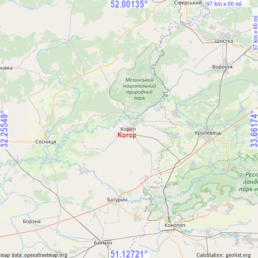
Korop GPS coordinates[2]
51° 33' 58.968" North, 32° 57' 30.996" East
| Map corner | latitude | longitude |
|---|---|---|
| Upper-left | 52.00135°, | 32.25549° |
| Center: | 51.56638°, | 32.95861° |
| Lower-right: | 51.12721°, | 33.66174° |
| Map W x H: | 97.2×97.2 km | = 60.4×60.4mi |
| max Lat: | 52.18903° ⇑1.7% North |
| Korop: | 51.56638° |
| min Lat: | ⇓98.3% South 44.39214° |
| min Long | Korop | max Long |
| 22.20555° | 32.95861° | 40.13222° |
| W 47.3%⇐ | ⇒52.7% E |
Elevation
Elevation of Korop is 126 m = 413 ft, and this is 29.8 m = 98 ft below average elevation for this country.
| Max E: |
886 m = 2907 ft | 52.7% |
| Avg. | 155.8 m = 511 ft | |
| Korop | 126 m = 413 ft | |
Min E: |
-3 m = -10 ft | 47.3% |
See also: Ukraine elevation on elevation.city.
Geographical zone
Korop is located in North temperate zone (between Tropic of Cancer and the Arctic Circle). Distance of this North polar circle is 1667.5 km =1036.1 mi to North.| Distance of | km | miles | from Korop |
|---|---|---|---|
| North Pole | 4273.4 | 2655.4 | to North |
| Arctic Circle | 1667.5 | 1036.1 | to North |
| Tropic Cancer | 3127.7 | 1943.5 | to South |
| Equator | 5733.6 | 3562.7 | to South |


Nearby cities:
15 places around Korop: (largest is in red/bold)
• Avdiyivka
25.8 km =16 mi,  334°
334°
• Bakhmach
42.6 km =26.5 mi,  197°
197°
• Bakhmach
43.7 km =27.2 mi,  191°
191°
• Baturyn
25.2 km =15.7 mi, 192°
• Borzna
50.6 km =31.4 mi,  226°
226°
• Hlukhiv
67.3 km =41.8 mi,  79°
79°
• Kholmy
41.9 km =26 mi,  323°
323°
• Konotop
40 km =24.9 mi,  154°
154°
• Koryukivka
53.9 km =33.5 mi,  294°
294°
• Krolevets’
29.5 km =18.3 mi,  94°
94°
• Mena
51.6 km =32.1 mi,  264°
264°
• Novhorod-Sivers’kyy
53.1 km =33 mi,  23°
23°
• Shostka
48.2 km =30 mi,  46°
46°
• Sloboda
60.8 km =37.8 mi,  132°
132°
• Sosnytsya
32.1 km =19.9 mi, 261°
Sources, notices
• [Note1] Compared only with cities in Ukraine existing in our database
• [Src1] Map data: © OpenStreetMap contributors (CC-BY-SA)
• [Src2] Other city data from geonames.org with taken over terms of usage.
• [Src3] Geographical zone / Annual Mean Temperature by Robert A. Rohde @ Wikipedia
