Chapayevka geodata
Chapayevka (Zaporizhia) is a populated place; located in Ukraine in Europe/Zaporozhye (GMT+3) time zone. With population of 3,502 people, there are 835 cities with bigger population in this country. Compared to other cities in Ukraine, 60.9% of cities are located further ↑North; 89.1% of cities are located further ←West and 59.9% of cities have higher elevation than Chapayevka. Note1


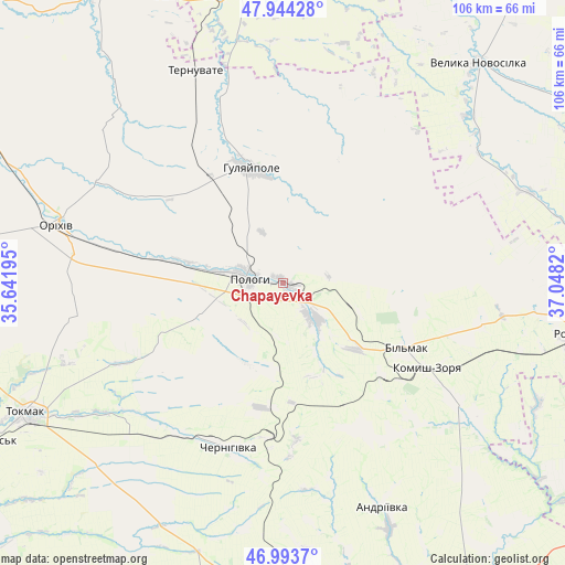
Chapayevka GPS coordinates[2]
47° 28' 16.104" North, 36° 20' 42.252" East
| Map corner | latitude | longitude |
|---|---|---|
| Upper-left | 47.94428°, | 35.64195° |
| Center: | 47.47114°, | 36.34507° |
| Lower-right: | 46.9937°, | 37.0482° |
| Map W x H: | 105.7×105.7 km | = 65.7×65.7mi |
| max Lat: | 52.18903° ⇑60.9% North |
| Chapayevka: | 47.47114° |
| min Lat: | ⇓39.1% South 44.39214° |
| min Long | Chapayevka | max Long |
| 22.20555° | 36.34507° | 40.13222° |
| W 89.1%⇐ | ⇒10.9% E |
Elevation
Elevation of Chapayevka is 106 m = 348 ft, and this is 49.8 m = 163 ft below average elevation for this country.
| Max E: |
886 m = 2907 ft | 59.9% |
| Avg. | 155.8 m = 511 ft | |
| Chapayevka | 106 m = 348 ft | |
Min E: |
-3 m = -10 ft | 40.1% |
See also: Ukraine elevation on elevation.city.
Geographical zone
Chapayevka is located in North temperate zone (between Tropic of Cancer and the Arctic Circle). Distance of this North polar circle is 2122.9 km =1319.1 mi to North.| Distance of | km | miles | from Chapayevka |
|---|---|---|---|
| North Pole | 4728.8 | 2938.3 | to North |
| Arctic Circle | 2122.9 | 1319.1 | to North |
| Tropic Cancer | 2672.4 | 1660.6 | to South |
| Equator | 5278.3 | 3279.8 | to South |


Nearby cities:
15 places around Chapayevka: (largest is in red/bold)
• Chernihivka
33.2 km =20.6 mi,  204°
204°
• Hulyaypole
22.4 km =13.9 mi,  342°
342°
• Kirove
52.8 km =32.8 mi,  292°
292°
• Komysh-Zorya
30.7 km =19.1 mi,  121°
121°
• Kuybysheve
26.1 km =16.2 mi, 118°
• Mala Tokmachka
34.7 km =21.6 mi,  281°
281°
• Orikhiv
43.3 km =26.9 mi, 284°
• Polohy
7 km =4.3 mi, 282°
• Preobrazhenka
41.2 km =25.6 mi, 285°
• Rozivka
55.2 km =34.3 mi,  100°
100°
• Temriuk
52.9 km =32.9 mi, 115°
• Ternuvate
43.1 km =26.8 mi, 337°
• Tokmak
53.4 km =33.2 mi,  243°
243°
• Velyka Novosilka
55.5 km =34.5 mi,  41°
41°
• Zaliznychne
24.3 km =15.1 mi,  326°
326°
Sources, notices
• [Note1] Compared only with cities in Ukraine existing in our database
• [Src1] Map data: © OpenStreetMap contributors (CC-BY-SA)
• [Src2] Other city data from geonames.org with taken over terms of usage.
• [Src3] Geographical zone / Annual Mean Temperature by Robert A. Rohde @ Wikipedia
