Mala Tokmachka geodata
Mala Tokmachka (Zaporizhia) is a populated place; located in Ukraine in Europe/Zaporozhye (GMT+3) time zone. With population of 2,912 people, there are 970 cities with bigger population in this country. Compared to other cities in Ukraine, 60.5% of cities are located further ↑North; 86.5% of cities are located further ←West and 73.8% of cities have higher elevation than Mala Tokmachka. Note1


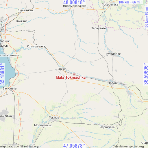
Mala Tokmachka GPS coordinates[2]
47° 32' 8.268" North, 35° 53' 34.548" East
| Map corner | latitude | longitude |
|---|---|---|
| Upper-left | 48.00818°, | 35.18981° |
| Center: | 47.53563°, | 35.89293° |
| Lower-right: | 47.05878°, | 36.59606° |
| Map W x H: | 105.6×105.6 km | = 65.6×65.6mi |
| max Lat: | 52.18903° ⇑60.5% North |
| Mala Tokmachka: | 47.53563° |
| min Lat: | ⇓39.5% South 44.39214° |
| min Long | Mala Tokmachka | max Long |
| 22.20555° | 35.89293° | 40.13222° |
| W 86.5%⇐ | ⇒13.5% E |
Elevation
Elevation of Mala Tokmachka is 65 m = 213 ft, and this is 90.8 m = 298 ft below average elevation for this country.
| Max E: |
886 m = 2907 ft | 73.8% |
| Avg. | 155.8 m = 511 ft | |
| Mala Tokmachka | 65 m = 213 ft | |
Min E: |
-3 m = -10 ft | 26.2% |
See also: Ukraine elevation on elevation.city.
Geographical zone
Mala Tokmachka is located in North temperate zone (between Tropic of Cancer and the Arctic Circle). Distance of this North polar circle is 2115.7 km =1314.6 mi to North.| Distance of | km | miles | from Mala Tokmachka |
|---|---|---|---|
| North Pole | 4721.6 | 2933.9 | to North |
| Arctic Circle | 2115.7 | 1314.6 | to North |
| Tropic Cancer | 2679.5 | 1665 | to South |
| Equator | 5285.5 | 3284.3 | to South |


Nearby cities:
15 places around Mala Tokmachka: (largest is in red/bold)
• Chapayevka
34.7 km =21.6 mi,  101°
101°
• Chernihivka
42.5 km =26.4 mi,  151°
151°
• Hulyaypole
30.8 km =19.1 mi,  62°
62°
• Kirove
19.8 km =12.3 mi,  311°
311°
• Komyshuvakha
33.8 km =21 mi, 306°
• Malokaterynivka
49.5 km =30.8 mi,  285°
285°
• Novomykolayivka
49.2 km =30.6 mi,  1°
1°
• Orikhiv
8.8 km =5.5 mi, 293°
• Polohy
27.7 km =17.2 mi, 101°
• Preobrazhenka
7 km =4.3 mi, 305°
• Pryshyb
53 km =32.9 mi,  234°
234°
• Ternuvate
37.2 km =23.1 mi,  28°
28°
• Tokmak
34 km =21.1 mi,  203°
203°
• Vasylivka
47.8 km =29.7 mi,  256°
256°
• Zaliznychne
24.2 km =15 mi, 57°
Sources, notices
• [Note1] Compared only with cities in Ukraine existing in our database
• [Src1] Map data: © OpenStreetMap contributors (CC-BY-SA)
• [Src2] Other city data from geonames.org with taken over terms of usage.
• [Src3] Geographical zone / Annual Mean Temperature by Robert A. Rohde @ Wikipedia
