Lamwo geodata
Lamwo (Northern Region) is a seat of a second-order administrative division; located in Uganda in Africa/Kampala (GMT+3) time zone. In our database, there are 80 cities with bigger population. Compared to other cities in Uganda, 99.3% of cities are located further ↓South; 60.3% of cities are located further ←West and 82.9% of cities have higher elevation than Lamwo. Note1
Administrative division(s):
- Level 1: Northern Region
- Level 2: Lamwo District
- Level 3: Lamwo County
- Level 4: Padibe Town Council


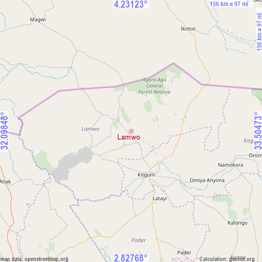
Lamwo GPS coordinates[2]
3° 31' 46.992" North, 32° 48' 5.76" East
| Map corner | latitude | longitude |
|---|---|---|
| Upper-left | 4.23123°, | 32.09848° |
| Center: | 3.52972°, | 32.8016° |
| Lower-right: | 2.82768°, | 33.50473° |
| Map W x H: | 156.1×156.1 km | = 97×97mi |
| max Lat: | 3.66088° ⇑0.7% North |
| Lamwo: | 3.52972° |
| min Lat: | ⇓99.3% South -1.28538° |
| min Long | Lamwo | max Long |
| 29.65° | 32.8016° | 34.95° |
| W 60.3%⇐ | ⇒39.7% E |
Elevation
Elevation of Lamwo is 1078 m = 3537 ft, and this is 181 m = 594 ft below average elevation for this country.
| Max E: |
4129 m = 13547 ft | 82.9% |
| Avg. | 1259 m = 4131 ft | |
| Lamwo | 1078 m = 3537 ft | |
Min E: |
622 m = 2041 ft | 17.1% |
See also: Uganda elevation on elevation.city.
Geographical zone
Lamwo is located in North Torrid zone (between Equator and Tropic of Cancer). Distance of Equator is 392.5 km =243.9 mi to South.| Distance of | km | miles | from Lamwo |
|---|---|---|---|
| North Pole | 9614.6 | 5974.2 | to North |
| Arctic Circle | 7008.7 | 4355 | to North |
| Tropic Cancer | 2213.5 | 1375.4 | to North |
| Equator | 392.5 | 243.9 | to South |


Nearby cities:
15 places around Lamwo: (largest is in red/bold)
• Abim
133.8 km =83.1 mi,  133°
133°
• Adjumani
113.4 km =70.5 mi,  261°
261°
• Agago
97.3 km =60.5 mi,  142°
142°
• Amuru
124.6 km =77.4 mi,  230°
230°
• Gulu
100.8 km =62.6 mi,  213°
213°
• Kaabong
149.6 km =93 mi,  91°
91°
• Kitgum
29.5 km =18.3 mi,  161°
161°
• Kole
125.6 km =78 mi,  180°
180°
• Lira
142.7 km =88.7 mi, 175°
• Moyo
120.4 km =74.8 mi,  276°
276°
• Nwoya
133.5 km =83 mi,  221°
221°
• Otuke
138.3 km =85.9 mi,  145°
145°
• Oyam
151.2 km =94 mi,  197°
197°
• Pader
70.5 km =43.8 mi, 139°
• Pader Palwo
89.1 km =55.4 mi, 155°
Sources, notices
• [Note1] Compared only with cities in Uganda existing in our database
• [Src1] Map data: © OpenStreetMap contributors (CC-BY-SA)
• [Src2] Other city data from geonames.org with taken over terms of usage.
• [Src3] Geographical zone / Annual Mean Temperature by Robert A. Rohde @ Wikipedia
