Moyo geodata
Moyo (Northern Region) is a seat of a second-order administrative division; located in Uganda in Africa/Kampala (GMT+3) time zone. With population of 18,800 people, there are 38 cities with bigger population in this country. Compared to other cities in Uganda, 100% of cities are located further ↓South; 63% of cities are located further →East and 95.9% of cities have higher elevation than Moyo. Note1
Administrative division(s):
- Level 1: Northern Region
- Level 2: Moyo District
- Level 3: West Moyo
- Level 4: Moyo Town Council


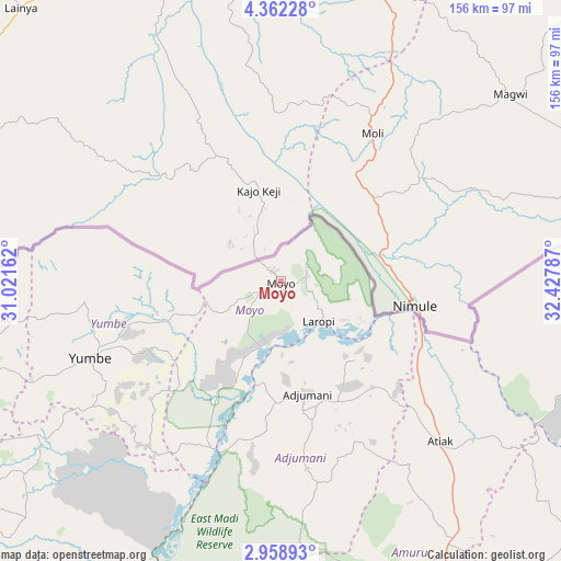
Moyo GPS coordinates[2]
3° 39' 39.168" North, 31° 43' 29.064" East
| Map corner | latitude | longitude |
|---|---|---|
| Upper-left | 4.36228°, | 31.02162° |
| Center: | 3.66088°, | 31.72474° |
| Lower-right: | 2.95893°, | 32.42787° |
| Map W x H: | 156×156 km | = 96.9×96.9mi |
| max Lat: | 3.66088° ⇑0% North |
| Moyo: | 3.66088° |
| min Lat: | ⇓100% South -1.28538° |
| min Long | Moyo | max Long |
| 29.65° | 31.72474° | 34.95° |
| W 37%⇐ | ⇒63% E |
Elevation
Elevation of Moyo is 973 m = 3192 ft, and this is 286 m = 938 ft below average elevation for this country.
| Max E: |
4129 m = 13547 ft | 95.9% |
| Avg. | 1259 m = 4131 ft | |
| Moyo | 973 m = 3192 ft | |
Min E: |
622 m = 2041 ft | 4.1% |
See also: Uganda elevation on elevation.city.
Geographical zone
Moyo is located in North Torrid zone (between Equator and Tropic of Cancer). Distance of Equator is 407.1 km =253 mi to South.| Distance of | km | miles | from Moyo |
|---|---|---|---|
| North Pole | 9600 | 5965.2 | to North |
| Arctic Circle | 6994.1 | 4345.9 | to North |
| Tropic Cancer | 2198.9 | 1366.3 | to North |
| Equator | 407.1 | 253 | to South |


Nearby cities:
15 places around Moyo: (largest is in red/bold)
• Adjumani
32.3 km =20.1 mi,  166°
166°
• Amuru
97.1 km =60.3 mi, 165°
• Arua
115 km =71.5 mi,  231°
231°
• Bulisa
175.1 km =108.8 mi,  191°
191°
• Gulu
117.4 km =72.9 mi,  147°
147°
• Kitgum
135.8 km =84.4 mi,  108°
108°
• Koboko
89.2 km =55.4 mi,  252°
252°
• Lamwo
120.4 km =74.8 mi,  96°
96°
• Maracha
95.8 km =59.5 mi,  243°
243°
• Nebbi
149.2 km =92.7 mi,  208°
208°
• Nwoya
118.2 km =73.4 mi,  164°
164°
• Oyam
174.7 km =108.6 mi, 155°
• Paidha
160.9 km =100 mi, 210°
• Yumbe
57.3 km =35.6 mi, 247°
• Zombo
156.4 km =97.2 mi,  215°
215°
Sources, notices
• [Note1] Compared only with cities in Uganda existing in our database
• [Src1] Map data: © OpenStreetMap contributors (CC-BY-SA)
• [Src2] Other city data from geonames.org with taken over terms of usage.
• [Src3] Geographical zone / Annual Mean Temperature by Robert A. Rohde @ Wikipedia
