Denov geodata
Denov (Surxondaryo) is a populated place; located in Uzbekistan in Asia/Samarkand (GMT+5) time zone. With population of 68,994 people, there are 18 cities with bigger population in this country. Compared to other cities in Uzbekistan, 98.3% of cities are located further ↑North; 51.7% of cities are located further ←West and 72.4% of cities have lower elevation than Denov. Note1


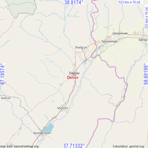
Denov GPS coordinates[2]
38° 16' 2.856" North, 67° 53' 55.896" East
| Map corner | latitude | longitude |
|---|---|---|
| Upper-left | 38.8174°, | 67.19574° |
| Center: | 38.26746°, | 67.89886° |
| Lower-right: | 37.71332°, | 68.60199° |
| Map W x H: | 122.8×122.8 km | = 76.3×76.3mi |
| max Lat: | 43.77877° ⇑98.3% North |
| Denov: | 38.26746° |
| min Lat: | ⇓1.7% South 37.22417° |
| min Long | Denov | max Long |
| 58.84596° | 67.89886° | 72.76177° |
| W 51.7%⇐ | ⇒48.3% E |
Elevation
Elevation of Denov is 525 m = 1722 ft, and this is 91.2 m = 299 ft above average elevation for this country.
| Max E: |
1464 m = 4803 ft | 27.6% |
| Denov | 525 m 1722 ft | |
| Avg. | 433.8 m = 1423 ft | |
Min E: |
50 m = 164 ft | 72.4% |
See also: Denov elevation on elevation.city.
Geographical zone
Denov is located in North temperate zone (between Tropic of Cancer and the Arctic Circle). Distance of this Northern Tropic circle is 1649 km =1024.6 mi to South.| Distance of | km | miles | from Denov |
|---|---|---|---|
| North Pole | 5752.1 | 3574.2 | to North |
| Arctic Circle | 3146.2 | 1955 | to North |
| Tropic Cancer | 1649 | 1024.6 | to South |
| Equator | 4254.9 | 2643.9 | to South |


Nearby cities:
15 places around Denov: (largest is in red/bold)
• Boysun
60.8 km =37.8 mi,  263°
263°
• Chiroqchi
143.3 km =89 mi,  306°
306°
• Chiroqchi Shahri
142.3 km =88.4 mi, 306°
• G‘uzor
149 km =92.6 mi,  285°
285°
• G‘uzor Shahri
149.4 km =92.8 mi, 285°
• Kitob
129.6 km =80.5 mi, 314°
• Kitob Shahri
130.1 km =80.8 mi,  316°
316°
• Qamashi Shahri
139.1 km =86.4 mi,  296°
296°
• Qorashina
116.8 km =72.6 mi,  274°
274°
• Shahrisabz
127.5 km =79.2 mi, 313°
• Shahrisabz Shahri
127.9 km =79.5 mi, 312°
• Sho‘rchi
31.4 km =19.5 mi,  198°
198°
• Tirmiz
128.2 km =79.7 mi,  205°
205°
• Urgut
138.4 km =86 mi,  335°
335°
• Yakkabog‘ Shahri
131.4 km =81.6 mi, 306°
Sources, notices
• [Note1] Compared only with cities in Uzbekistan existing in our database
• [Src1] Map data: © OpenStreetMap contributors (CC-BY-SA)
• [Src2] Other city data from geonames.org with taken over terms of usage.
• [Src3] Geographical zone / Annual Mean Temperature by Robert A. Rohde @ Wikipedia
