Phalaborwa geodata
Phalaborwa (Limpopo) is a seat of a third-order administrative division; located in South Africa in Africa/Johannesburg (GMT+2) time zone. With population of 109,468 people, there are 49 cities with bigger population in this country. Compared to other cities in South Africa, 95.9% of cities are located further ↓South; 93.8% of cities are located further ←West and 77.9% of cities have higher elevation than Phalaborwa. Note1
Administrative division(s):
- Level 1: Limpopo
- Level 2: Mopani District Municipality
- Level 3: Ba-Phalaborwa


Phalaborwa GPS coordinates[2]
23° 56' 34.764" South, 31° 8' 27.852" East
| Map corner | latitude | longitude |
|---|---|---|
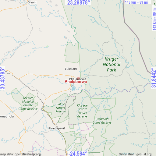
| Upper-left | -23.29878°, | 30.43795° |
| Center: | -23.94299°, | 31.14107° |
| Lower-right: | -24.584°, | 31.8442° |
| Map W x H: | 142.9×142.9 km | = 88.8×88.8mi |
| max Lat: | -22.34881° ⇑4.1% North |
| Phalaborwa: | -23.94299° |
| min Lat: | ⇓95.9% South -34.66739° |
| min Long | Phalaborwa | max Long |
| 16.8697° | 31.14107° | 32.26762° |
| W 93.8%⇐ | ⇒6.2% E |
Elevation
Elevation of Phalaborwa is 435 m = 1427 ft, and this is 534.6 m = 1754 ft below average elevation for this country.
| Max E: |
1873 m = 6145 ft | 77.9% |
| Avg. | 969.6 m = 3181 ft | |
| Phalaborwa | 435 m = 1427 ft | |
Min E: |
7 m = 23 ft | 22.1% |
See also: Phalaborwa elevation on elevation.city.
Geographical zone
Phalaborwa is located in South temperate zone (between Tropic of Capricorn and the Antarctic Circle). Distance of this Southern Tropic circle is 56.3 km =35 mi to North.| Distance of | km | miles | from Phalaborwa |
|---|---|---|---|
| Equator | 2662.2 | 1654.2 | to North |
| Tropic Capricorn | 56.3 | 35 | to North |
| Antarctic Circle | 4739 | 2944.7 | to South |
| South Pole | 7344.9 | 4563.9 | to South |


Nearby cities:
15 places around Phalaborwa: (largest is in red/bold)
• Apel
150.5 km =93.5 mi,  249°
249°
• Burgersfort
115.8 km =72 mi,  225°
225°
• Duiwelskloof
105.5 km =65.6 mi,  285°
285°
• Ga-Kgapane
99.1 km =61.6 mi, 289°
• Giyani
83.2 km =51.7 mi,  328°
328°
• Hoedspruit
49.2 km =30.6 mi,  202°
202°
• Jane Furse
157.6 km =97.9 mi, 234°
• Louis Trichardt
161 km =100 mi,  308°
308°
• Lydenburg
146.3 km =90.9 mi,  208°
208°
• Mankoeng
134.7 km =83.7 mi,  272°
272°
• Nkowakowa
87 km =54.1 mi, 274°
• Thohoyandou
129.5 km =80.5 mi, 328°
• Thulamahashi
87.1 km =54.1 mi,  176°
176°
• Tzaneen
100.1 km =62.2 mi,  277°
277°
• White River
155 km =96.3 mi, 184°
Sources, notices
• [Note1] Compared only with cities in South Africa existing in our database
• [Src1] Map data: © OpenStreetMap contributors (CC-BY-SA)
• [Src2] Other city data from geonames.org with taken over terms of usage.
• [Src3] Geographical zone / Annual Mean Temperature by Robert A. Rohde @ Wikipedia
