Wesselsbron geodata
Wesselsbron (Orange Free State) is a populated place; located in South Africa in Africa/Johannesburg (GMT+2) time zone. With population of 42,552 people, there are 102 cities with bigger population in this country. Compared to other cities in South Africa, 59% of cities are located further ↓South; 66.1% of cities are located further →East and 64.9% of cities have lower elevation than Wesselsbron. Note1
Administrative division(s):
- Level 1: Orange Free State
- Level 2: Lejweleputswa District Municipality
- Level 3: Nala


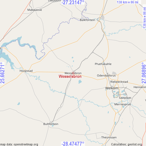
Wesselsbron GPS coordinates[2]
27° 51' 17.64" South, 26° 21' 56.988" East
| Map corner | latitude | longitude |
|---|---|---|
| Upper-left | -27.23147°, | 25.66271° |
| Center: | -27.8549°, | 26.36583° |
| Lower-right: | -28.47477°, | 27.06896° |
| Map W x H: | 138.2×138.2 km | = 85.9×85.9mi |
| max Lat: | -22.34881° ⇑41% North |
| Wesselsbron: | -27.8549° |
| min Lat: | ⇓59% South -34.66739° |
| min Long | Wesselsbron | max Long |
| 16.8697° | 26.36583° | 32.26762° |
| W 33.9%⇐ | ⇒66.1% E |
Elevation
Elevation of Wesselsbron is 1315 m = 4314 ft, and this is 345.4 m = 1133 ft above average elevation for this country.
| Max E: |
1873 m = 6145 ft | 35.1% |
| Wesselsbron | 1315 m 4314 ft | |
| Avg. | 969.6 m = 3181 ft | |
Min E: |
7 m = 23 ft | 64.9% |
See also: Wesselsbron elevation on elevation.city.
Geographical zone
Wesselsbron is located in South temperate zone (between Tropic of Capricorn and the Antarctic Circle). Distance of this Southern Tropic circle is 491.3 km =305.3 mi to North.| Distance of | km | miles | from Wesselsbron |
|---|---|---|---|
| Equator | 3097.2 | 1924.5 | to North |
| Tropic Capricorn | 491.3 | 305.3 | to North |
| Antarctic Circle | 4304 | 2674.4 | to South |
| South Pole | 6909.9 | 4293.6 | to South |


Nearby cities:
15 places around Wesselsbron: (largest is in red/bold)
• Allanridge
29.5 km =18.3 mi,  67°
67°
• Bloemhof
78.2 km =48.6 mi,  287°
287°
• Bothaville
57.4 km =35.7 mi,  25°
25°
• Brandfort
94.4 km =58.7 mi,  174°
174°
• Bultfontein
52.6 km =32.7 mi,  203°
203°
• Hennenman
66.1 km =41.1 mi,  101°
101°
• Hoopstad
45 km =28 mi,  273°
273°
• Kroonstad
88.5 km =55 mi,  75°
75°
• Kutloanong
37.8 km =23.5 mi,  86°
86°
• Theunissen
70 km =43.5 mi,  152°
152°
• Ventersburg
80.1 km =49.8 mi,  108°
108°
• Viljoenskroon
92 km =57.2 mi,  38°
38°
• Virginia
56.4 km =35 mi,  119°
119°
• Welkom
38.8 km =24.1 mi, 110°
• Wolmaransstad
82.3 km =51.1 mi,  332°
332°
Sources, notices
• [Note1] Compared only with cities in South Africa existing in our database
• [Src1] Map data: © OpenStreetMap contributors (CC-BY-SA)
• [Src2] Other city data from geonames.org with taken over terms of usage.
• [Src3] Geographical zone / Annual Mean Temperature by Robert A. Rohde @ Wikipedia
