Port Alfred geodata
Port Alfred (Eastern Cape) is a seat of a third-order administrative division; located in South Africa in Africa/Johannesburg (GMT+2) time zone. With population of 17,959 people, there are 151 cities with bigger population in this country. Compared to other cities in South Africa, 89.4% of cities are located further ↑North; 59.9% of cities are located further →East and 95% of cities have higher elevation than Port Alfred. Note1
Administrative division(s):
- Level 1: Eastern Cape
- Level 2: Cacadu District Municipality
- Level 3: Ndlambe


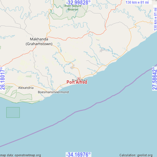
Port Alfred GPS coordinates[2]
33° 35' 9.636" South, 26° 52' 59.844" East
| Map corner | latitude | longitude |
|---|---|---|
| Upper-left | -32.99828°, | 26.18017° |
| Center: | -33.58601°, | 26.88329° |
| Lower-right: | -34.16976°, | 27.58642° |
| Map W x H: | 130.3×130.3 km | = 81×81mi |
| max Lat: | -22.34881° ⇑89.4% North |
| Port Alfred: | -33.58601° |
| min Lat: | ⇓10.6% South -34.66739° |
| min Long | Port Alfred | max Long |
| 16.8697° | 26.88329° | 32.26762° |
| W 40.1%⇐ | ⇒59.9% E |
Elevation
Elevation of Port Alfred is 35 m = 115 ft, and this is 934.6 m = 3066 ft below average elevation for this country.
| Max E: |
1873 m = 6145 ft | 95% |
| Avg. | 969.6 m = 3181 ft | |
| Port Alfred | 35 m = 115 ft | |
Min E: |
7 m = 23 ft | 5% |
See also: South Africa elevation on elevation.city.
Geographical zone
Port Alfred is located in South temperate zone (between Tropic of Capricorn and the Antarctic Circle). Distance of this Southern Tropic circle is 1128.5 km =701.2 mi to North.| Distance of | km | miles | from Port Alfred |
|---|---|---|---|
| Equator | 3734.4 | 2320.4 | to North |
| Tropic Capricorn | 1128.5 | 701.2 | to North |
| Antarctic Circle | 3666.8 | 2278.4 | to South |
| South Pole | 6272.6 | 3897.6 | to South |


Nearby cities:
15 places around Port Alfred: (largest is in red/bold)
• Adelaide
112 km =69.6 mi,  330°
330°
• Alice
88.9 km =55.2 mi,  357°
357°
• Bhisho
97.2 km =60.4 mi,  32°
32°
• East London
114.7 km =71.3 mi,  56°
56°
• Fort Beaufort
93.1 km =57.8 mi,  345°
345°
• Grahamstown
45.2 km =28.1 mi,  313°
313°
• Ilinge
179.6 km =111.6 mi,  4°
4°
• Kirkwood
135.2 km =84 mi,  278°
278°
• Komga
146.3 km =90.9 mi,  39°
39°
• Peddie
47.9 km =29.8 mi, 26°
• Port Elizabeth
124.4 km =77.3 mi,  250°
250°
• Somerset East
154.2 km =95.8 mi, 308°
• Stutterheim
123.6 km =76.8 mi,  24°
24°
• Uitenhage
138.8 km =86.2 mi,  262°
262°
• Whittlesea
156.9 km =97.5 mi, 357°
Sources, notices
• [Note1] Compared only with cities in South Africa existing in our database
• [Src1] Map data: © OpenStreetMap contributors (CC-BY-SA)
• [Src2] Other city data from geonames.org with taken over terms of usage.
• [Src3] Geographical zone / Annual Mean Temperature by Robert A. Rohde @ Wikipedia
