Kuhsān geodata
Kuhsān (Herat) is a seat of a second-order administrative division; located in Afghanistan in Asia/Kabul (GMT+4.5) time zone. With population of 12,087 people, there are 61 cities with bigger population in this country. Compared to other cities in Afghanistan, 50.5% of cities are located further ↑North; 99.7% of cities are located further →East and 79.1% of cities have higher elevation than Kuhsān. Note1


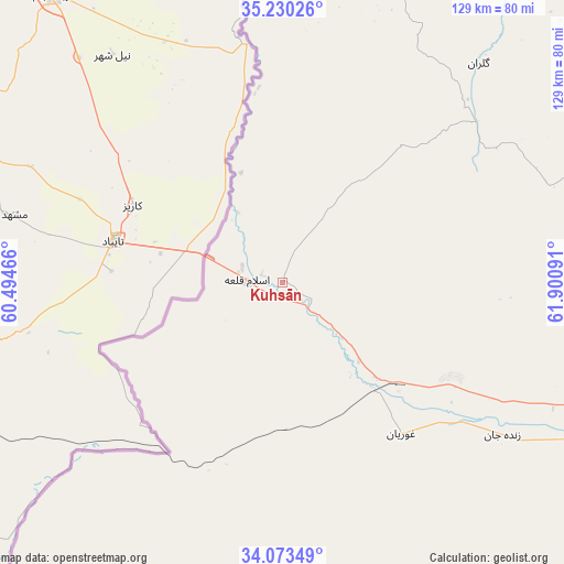
Kuhsān GPS coordinates[2]
34° 39' 14.004" North, 61° 11' 52.008" East
| Map corner | latitude | longitude |
|---|---|---|
| Upper-left | 35.23026°, | 60.49466° |
| Center: | 34.65389°, | 61.19778° |
| Lower-right: | 34.07349°, | 61.90091° |
| Map W x H: | 128.6×128.6 km | = 79.9×79.9mi |
| max Lat: | 38.4435° ⇑50.5% North |
| Kuhsān: | 34.65389° |
| min Lat: | ⇓49.5% South 30.15° |
| min Long | Kuhsān | max Long |
| 61.06667° | 61.19778° | 72.318° |
| W 0.3%⇐ | ⇒99.7% E |
Elevation
Elevation of Kuhsān is 740 m = 2428 ft, and this is 678.4 m = 2226 ft below average elevation for this country.
| Max E: |
3068 m = 10066 ft | 79.1% |
| Avg. | 1418.4 m = 4654 ft | |
| Kuhsān | 740 m = 2428 ft | |
Min E: |
254 m = 833 ft | 20.9% |
See also: Afghanistan elevation on elevation.city.
Geographical zone
Kuhsān is located in North temperate zone (between Tropic of Cancer and the Arctic Circle). Distance of this Northern Tropic circle is 1247.2 km =775 mi to South.| Distance of | km | miles | from Kuhsān |
|---|---|---|---|
| North Pole | 6153.9 | 3823.9 | to North |
| Arctic Circle | 3548 | 2204.6 | to North |
| Tropic Cancer | 1247.2 | 775 | to South |
| Equator | 3853.2 | 2394.3 | to South |


Nearby cities:
15 places around Kuhsān: (largest is in red/bold)
• Adraskan
149.3 km =92.8 mi,  138°
138°
• Chahār Burj
101.9 km =63.3 mi,  116°
116°
• Ghōriyān
43.7 km =27.2 mi, 141°
• Guz̄arah
105.2 km =65.4 mi, 117°
• Herāt
97.9 km =60.8 mi,  110°
110°
• Injīl
103.8 km =64.5 mi, 112°
• Kafir Qala
12.1 km =7.5 mi,  276°
276°
• Karukh
128.6 km =79.9 mi,  98°
98°
• Kushk
166.3 km =103.3 mi,  155°
155°
• Kushk-e Kuhnah
125.6 km =78 mi,  78°
78°
• Qarah Bāgh
61.6 km =38.3 mi,  58°
58°
• Rabāţ-e Sangī-ye Pā’īn
87.5 km =54.4 mi, 79°
• Shīnḏanḏ
173.9 km =108.1 mi,  149°
149°
• Tīr Pul
9.3 km =5.8 mi, 135°
• Zindah Jān
61.1 km =38 mi, 124°
Sources, notices
• [Note1] Compared only with cities in Afghanistan existing in our database
• [Src1] Map data: © OpenStreetMap contributors (CC-BY-SA)
• [Src2] Other city data from geonames.org with taken over terms of usage.
• [Src3] Geographical zone / Annual Mean Temperature by Robert A. Rohde @ Wikipedia
