Kushk geodata
Kushk (Herat) is a populated place; located in Afghanistan in Asia/Kabul (GMT+4.5) time zone. With population of 16,952 people, there are 40 cities with bigger population in this country. Compared to other cities in Afghanistan, 77.5% of cities are located further ↑North; 96.1% of cities are located further →East and 61.7% of cities have higher elevation than Kushk. Note1


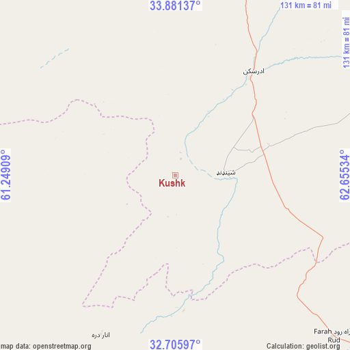
Kushk GPS coordinates[2]
33° 17' 44.34" North, 61° 57' 7.956" East
| Map corner | latitude | longitude |
|---|---|---|
| Upper-left | 33.88137°, | 61.24909° |
| Center: | 33.29565°, | 61.95221° |
| Lower-right: | 32.70597°, | 62.65534° |
| Map W x H: | 130.7×130.7 km | = 81.2×81.2mi |
| max Lat: | 38.4435° ⇑77.5% North |
| Kushk: | 33.29565° |
| min Lat: | ⇓22.5% South 30.15° |
| min Long | Kushk | max Long |
| 61.06667° | 61.95221° | 72.318° |
| W 3.9%⇐ | ⇒96.1% E |
Elevation
Elevation of Kushk is 1115 m = 3658 ft, and this is 303.4 m = 995 ft below average elevation for this country.
| Max E: |
3068 m = 10066 ft | 61.7% |
| Avg. | 1418.4 m = 4654 ft | |
| Kushk | 1115 m = 3658 ft | |
Min E: |
254 m = 833 ft | 38.3% |
See also: Afghanistan elevation on elevation.city.
Geographical zone
Kushk is located in North temperate zone (between Tropic of Cancer and the Arctic Circle). Distance of this Northern Tropic circle is 1096.2 km =681.1 mi to South.| Distance of | km | miles | from Kushk |
|---|---|---|---|
| North Pole | 6304.9 | 3917.7 | to North |
| Arctic Circle | 3699 | 2298.5 | to North |
| Tropic Cancer | 1096.2 | 681.1 | to South |
| Equator | 3702.1 | 2300.4 | to South |


Nearby cities:
15 places around Kushk: (largest is in red/bold)
• Adraskan
48.8 km =30.3 mi,  37°
37°
• Anār Darah
65.9 km =40.9 mi,  204°
204°
• Chahār Burj
107.8 km =67 mi,  11°
11°
• Dū Qal‘ah
136.7 km =84.9 mi, 200°
• Farah
103.6 km =64.4 mi,  171°
171°
• Ghōriyān
124.1 km =77.1 mi,  340°
340°
• Guz̄arah
104.7 km =65.1 mi, 13°
• Herāt
119.2 km =74.1 mi, 11°
• Injīl
115.1 km =71.5 mi, 13°
• Karukh
144.2 km =89.6 mi,  23°
23°
• Kushkak
118.8 km =73.8 mi, 199°
• Markaz-e Ḩukūmat-e Sulţān-e Bakwāh
149.8 km =93.1 mi,  141°
141°
• Qal‘ah-ye Fārsī
131.8 km =81.9 mi,  65°
65°
• Shīnḏanḏ
18.2 km =11.3 mi,  87°
87°
• Zindah Jān
118 km =73.3 mi,  350°
350°
Sources, notices
• [Note1] Compared only with cities in Afghanistan existing in our database
• [Src1] Map data: © OpenStreetMap contributors (CC-BY-SA)
• [Src2] Other city data from geonames.org with taken over terms of usage.
• [Src3] Geographical zone / Annual Mean Temperature by Robert A. Rohde @ Wikipedia
