Rabāţ-e Sangī-ye Pā’īn geodata
Rabāţ-e Sangī-ye Pā’īn (Herat) is a seat of a second-order administrative division; located in Afghanistan in Asia/Kabul (GMT+4.5) time zone. In our database, there are 93 cities with bigger population. Compared to other cities in Afghanistan, 53.7% of cities are located further ↓South; 95.5% of cities are located further →East and 58.2% of cities have higher elevation than Rabāţ-e Sangī-ye Pā’īn. Note1
Current local time in Rabāţ-e Sangī-ye Pā’īn:
10:30 PM, TuesdayDifference from your time zone: hours


Rabāţ-e Sangī-ye Pā’īn GPS coordinates[2]
34° 47' 58.236" North, 62° 8' 21.012" East
| Map corner | latitude | longitude |
|---|---|---|
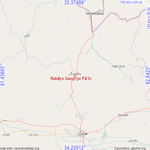
| Upper-left | 35.37486°, | 61.43605° |
| Center: | 34.79951°, | 62.13917° |
| Lower-right: | 34.22012°, | 62.8423° |
| Map W x H: | 128.4×128.4 km | = 79.8×79.8mi |
| max Lat: | 38.4435° ⇑46.3% North |
| Rabāţ-e Sangī-ye Pā’īn: | 34.79951° |
| min Lat: | ⇓53.7% South 30.15° |
| min Long | Rabāţ-e Sang� | max Long |
| 61.06667° | 62.13917° | 72.318° |
| W 4.5%⇐ | ⇒95.5% E |
Elevation
Elevation of Rabāţ-e Sangī-ye Pā’īn is 1192 m = 3911 ft, and this is 226.4 m = 743 ft below average elevation for this country.
| Max E: |
3068 m = 10066 ft | 58.2% |
| Avg. | 1418.4 m = 4654 ft | |
| Rabāţ-e Sangī-ye Pā’īn | 1192 m = 3911 ft | |
Min E: |
254 m = 833 ft | 41.8% |
See also: Afghanistan elevation on elevation.city.
Geographical zone
Rabāţ-e Sangī-ye Pā’īn is located in North temperate zone (between Tropic of Cancer and the Arctic Circle). Distance of this Northern Tropic circle is 1263.4 km =785 mi to South.| Distance of | km | miles | from Rabāţ-e Sangī-ye Pā’īn |
|---|---|---|---|
| North Pole | 6137.7 | 3813.8 | to North |
| Arctic Circle | 3531.8 | 2194.6 | to North |
| Tropic Cancer | 1263.4 | 785 | to South |
| Equator | 3869.3 | 2404.3 | to South |


Nearby cities:
15 places around Rabāţ-e Sangī-ye Pā’īn: (largest is in red/bold)
• Chahār Burj
61.9 km =38.5 mi,  175°
175°
• Ghōriyān
77.8 km =48.3 mi,  229°
229°
• Guz̄arah
65.6 km =40.8 mi,  174°
174°
• Herāt
50.5 km =31.4 mi, 173°
• Injīl
56.2 km =34.9 mi, 169°
• Kafir Qala
99.1 km =61.6 mi,  261°
261°
• Karukh
54.1 km =33.6 mi,  130°
130°
• Kuhsān
87.5 km =54.4 mi, 259°
• Kushk-e Kuhnah
38.1 km =23.7 mi,  77°
77°
• Qala i Naw
92.6 km =57.5 mi, 76°
• Qarah Bāgh
36.6 km =22.7 mi,  295°
295°
• Sang Atesh
93.2 km =57.9 mi,  57°
57°
• Tīr Pul
82.8 km =51.4 mi,  253°
253°
• Zindah Jān
62.2 km =38.6 mi,  215°
215°
• Āb-e Kamarī
90.5 km =56.2 mi,  69°
69°
Sources, notices
• [Note1] Compared only with cities in Afghanistan existing in our database
• [Src1] Map data: © OpenStreetMap contributors (CC-BY-SA)
• [Src2] Other city data from geonames.org with taken over terms of usage.
• [Src3] Geographical zone / Annual Mean Temperature by Robert A. Rohde @ Wikipedia
