Ghōriyān geodata
Ghōriyān (Herat) is a seat of a second-order administrative division; located in Afghanistan in Asia/Kabul (GMT+4.5) time zone. In our database, there are 93 cities with bigger population. Compared to other cities in Afghanistan, 59.2% of cities are located further ↑North; 98.7% of cities are located further →East and 76.5% of cities have higher elevation than Ghōriyān. Note1


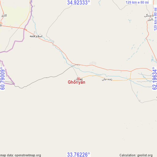
Ghōriyān GPS coordinates[2]
34° 20' 41.28" North, 61° 29' 35.556" East
| Map corner | latitude | longitude |
|---|---|---|
| Upper-left | 34.92333°, | 60.79009° |
| Center: | 34.3448°, | 61.49321° |
| Lower-right: | 33.76226°, | 62.19634° |
| Map W x H: | 129.1×129.1 km | = 80.2×80.2mi |
| max Lat: | 38.4435° ⇑59.2% North |
| Ghōriyān: | 34.3448° |
| min Lat: | ⇓40.8% South 30.15° |
| min Long | Ghōriyān | max Long |
| 61.06667° | 61.49321° | 72.318° |
| W 1.3%⇐ | ⇒98.7% E |
Elevation
Elevation of Ghōriyān is 796 m = 2612 ft, and this is 622.4 m = 2042 ft below average elevation for this country.
| Max E: |
3068 m = 10066 ft | 76.5% |
| Avg. | 1418.4 m = 4654 ft | |
| Ghōriyān | 796 m = 2612 ft | |
Min E: |
254 m = 833 ft | 23.5% |
See also: Afghanistan elevation on elevation.city.
Geographical zone
Ghōriyān is located in North temperate zone (between Tropic of Cancer and the Arctic Circle). Distance of this Northern Tropic circle is 1212.9 km =753.7 mi to South.| Distance of | km | miles | from Ghōriyān |
|---|---|---|---|
| North Pole | 6188.3 | 3845.2 | to North |
| Arctic Circle | 3582.4 | 2226 | to North |
| Tropic Cancer | 1212.9 | 753.7 | to South |
| Equator | 3818.8 | 2372.9 | to South |


Nearby cities:
15 places around Ghōriyān: (largest is in red/bold)
• Adraskan
105.7 km =65.7 mi,  137°
137°
• Chahār Burj
65.1 km =40.5 mi,  99°
99°
• Guz̄arah
67.7 km =42.1 mi, 102°
• Herāt
64.9 km =40.3 mi,  89°
89°
• Injīl
69.3 km =43.1 mi, 93°
• Kafir Qala
53 km =32.9 mi,  312°
312°
• Karukh
101.4 km =63 mi,  81°
81°
• Kuhsān
43.7 km =27.2 mi,  321°
321°
• Kushk
124.1 km =77.1 mi,  160°
160°
• Kushk-e Kuhnah
112.9 km =70.2 mi,  58°
58°
• Qarah Bāgh
71.1 km =44.2 mi,  21°
21°
• Rabāţ-e Sangī-ye Pā’īn
77.8 km =48.3 mi,  49°
49°
• Shīnḏanḏ
130.7 km =81.2 mi,  152°
152°
• Tīr Pul
34.5 km =21.4 mi, 323°
• Zindah Jān
23.3 km =14.5 mi, 90°
Sources, notices
• [Note1] Compared only with cities in Afghanistan existing in our database
• [Src1] Map data: © OpenStreetMap contributors (CC-BY-SA)
• [Src2] Other city data from geonames.org with taken over terms of usage.
• [Src3] Geographical zone / Annual Mean Temperature by Robert A. Rohde @ Wikipedia
