Chahār Burj geodata
Chahār Burj (Herat) is a populated place; located in Afghanistan in Asia/Kabul (GMT+4.5) time zone. With population of 11,935 people, there are 63 cities with bigger population in this country. Compared to other cities in Afghanistan, 61.7% of cities are located further ↑North; 94.9% of cities are located further →East and 69.8% of cities have higher elevation than Chahār Burj. Note1


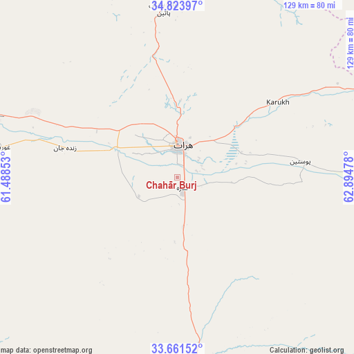
Chahār Burj GPS coordinates[2]
34° 14' 41.1" North, 62° 11' 29.94" East
| Map corner | latitude | longitude |
|---|---|---|
| Upper-left | 34.82397°, | 61.48853° |
| Center: | 34.24475°, | 62.19165° |
| Lower-right: | 33.66152°, | 62.89478° |
| Map W x H: | 129.3×129.3 km | = 80.3×80.3mi |
| max Lat: | 38.4435° ⇑61.7% North |
| Chahār Burj: | 34.24475° |
| min Lat: | ⇓38.3% South 30.15° |
| min Long | Chahār Burj | max Long |
| 61.06667° | 62.19165° | 72.318° |
| W 5.1%⇐ | ⇒94.9% E |
Elevation
Elevation of Chahār Burj is 943 m = 3094 ft, and this is 475.4 m = 1560 ft below average elevation for this country.
| Max E: |
3068 m = 10066 ft | 69.8% |
| Avg. | 1418.4 m = 4654 ft | |
| Chahār Burj | 943 m = 3094 ft | |
Min E: |
254 m = 833 ft | 30.2% |
See also: Afghanistan elevation on elevation.city.
Geographical zone
Chahār Burj is located in North temperate zone (between Tropic of Cancer and the Arctic Circle). Distance of this Northern Tropic circle is 1201.7 km =746.7 mi to South.| Distance of | km | miles | from Chahār Burj |
|---|---|---|---|
| North Pole | 6199.4 | 3852.1 | to North |
| Arctic Circle | 3593.5 | 2232.9 | to North |
| Tropic Cancer | 1201.7 | 746.7 | to South |
| Equator | 3807.7 | 2366 | to South |


Nearby cities:
15 places around Chahār Burj: (largest is in red/bold)
• Adraskan
67 km =41.6 mi,  173°
173°
• Ghōriyān
65.1 km =40.5 mi,  279°
279°
• Guz̄arah
4.1 km =2.5 mi,  152°
152°
• Herāt
11.5 km =7.1 mi,  3°
3°
• Injīl
8.1 km =5 mi,  38°
38°
• Karukh
44.8 km =27.8 mi,  54°
54°
• Kuhsān
101.9 km =63.3 mi,  296°
296°
• Kushk
107.8 km =67 mi,  191°
191°
• Kushk-e Kuhnah
76.9 km =47.8 mi,  25°
25°
• Qarah Bāgh
86.2 km =53.6 mi,  333°
333°
• Qaryeh-ye Owbeh
91.5 km =56.9 mi,  81°
81°
• Rabāţ-e Sangī-ye Pā’īn
61.9 km =38.5 mi,  355°
355°
• Shīnḏanḏ
104.8 km =65.1 mi,  182°
182°
• Tīr Pul
93.1 km =57.8 mi,  294°
294°
• Zindah Jān
42.3 km =26.3 mi, 284°
Sources, notices
• [Note1] Compared only with cities in Afghanistan existing in our database
• [Src1] Map data: © OpenStreetMap contributors (CC-BY-SA)
• [Src2] Other city data from geonames.org with taken over terms of usage.
• [Src3] Geographical zone / Annual Mean Temperature by Robert A. Rohde @ Wikipedia
