Herāt geodata
Herāt (Herat) is a seat of a first-order administrative division; located in Afghanistan in Asia/Kabul (GMT+4.5) time zone. With population of 272,806 people, there are 3 cities with bigger population in this country. Compared to other cities in Afghanistan, 58.5% of cities are located further ↑North; 94.5% of cities are located further →East and 70.7% of cities have higher elevation than Herāt. Note1


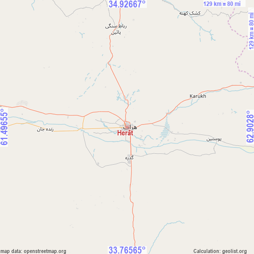
Herāt GPS coordinates[2]
34° 20' 53.412" North, 62° 11' 58.812" East
| Map corner | latitude | longitude |
|---|---|---|
| Upper-left | 34.92667°, | 61.49655° |
| Center: | 34.34817°, | 62.19967° |
| Lower-right: | 33.76565°, | 62.9028° |
| Map W x H: | 129.1×129.1 km | = 80.2×80.2mi |
| max Lat: | 38.4435° ⇑58.5% North |
| Herāt: | 34.34817° |
| min Lat: | ⇓41.5% South 30.15° |
| min Long | Herāt | max Long |
| 61.06667° | 62.19967° | 72.318° |
| W 5.5%⇐ | ⇒94.5% E |
Elevation
Elevation of Herāt is 927 m = 3041 ft, and this is 491.4 m = 1612 ft below average elevation for this country.
| Max E: |
3068 m = 10066 ft | 70.7% |
| Avg. | 1418.4 m = 4654 ft | |
| Herāt | 927 m = 3041 ft | |
Min E: |
254 m = 833 ft | 29.3% |
See also: Herāt elevation on elevation.city.
Geographical zone
Herāt is located in North temperate zone (between Tropic of Cancer and the Arctic Circle). Distance of this Northern Tropic circle is 1213.2 km =753.8 mi to South.| Distance of | km | miles | from Herāt |
|---|---|---|---|
| North Pole | 6187.9 | 3845 | to North |
| Arctic Circle | 3582 | 2225.8 | to North |
| Tropic Cancer | 1213.2 | 753.8 | to South |
| Equator | 3819.2 | 2373.1 | to South |


Nearby cities:
15 places around Herāt: (largest is in red/bold)
• Adraskan
78.4 km =48.7 mi,  175°
175°
• Chahār Burj
11.5 km =7.1 mi, 183°
• Ghōriyān
64.9 km =40.3 mi,  269°
269°
• Guz̄arah
15.2 km =9.4 mi, 175°
• Injīl
6.7 km =4.2 mi,  140°
140°
• Kafir Qala
109.7 km =68.2 mi,  288°
288°
• Karukh
38.4 km =23.9 mi,  67°
67°
• Kuhsān
97.9 km =60.8 mi, 290°
• Kushk-e Kuhnah
66.3 km =41.2 mi,  28°
28°
• Qala i Naw
110.8 km =68.8 mi,  50°
50°
• Qarah Bāgh
76.4 km =47.5 mi,  329°
329°
• Qaryeh-ye Owbeh
89.7 km =55.7 mi,  88°
88°
• Rabāţ-e Sangī-ye Pā’īn
50.5 km =31.4 mi,  353°
353°
• Tīr Pul
89.6 km =55.7 mi, 287°
• Zindah Jān
41.6 km =25.8 mi, 269°
Sources, notices
• [Note1] Compared only with cities in Afghanistan existing in our database
• [Src1] Map data: © OpenStreetMap contributors (CC-BY-SA)
• [Src2] Other city data from geonames.org with taken over terms of usage.
• [Src3] Geographical zone / Annual Mean Temperature by Robert A. Rohde @ Wikipedia
