Adraskan geodata
Adraskan (Herat) is a seat of a second-order administrative division; located in Afghanistan in Asia/Kabul (GMT+4.5) time zone. In our database, there are 93 cities with bigger population. Compared to other cities in Afghanistan, 72.3% of cities are located further ↑North; 93.6% of cities are located further →East and 50.2% of cities have lower elevation than Adraskan. Note1


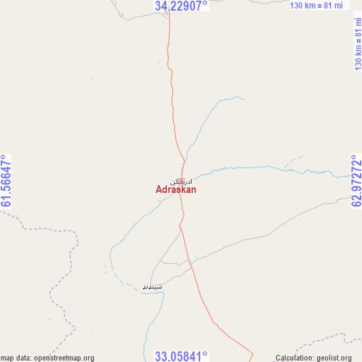
Adraskan GPS coordinates[2]
33° 38' 44.628" North, 62° 16' 10.524" East
| Map corner | latitude | longitude |
|---|---|---|
| Upper-left | 34.22907°, | 61.56647° |
| Center: | 33.64573°, | 62.26959° |
| Lower-right: | 33.05841°, | 62.97272° |
| Map W x H: | 130.2×130.2 km | = 80.9×80.9mi |
| max Lat: | 38.4435° ⇑72.3% North |
| Adraskan: | 33.64573° |
| min Lat: | ⇓27.7% South 30.15° |
| min Long | Adraskan | max Long |
| 61.06667° | 62.26959° | 72.318° |
| W 6.4%⇐ | ⇒93.6% E |
Elevation
Elevation of Adraskan is 1352 m = 4436 ft, and this is 66.4 m = 218 ft below average elevation for this country.
| Max E: |
3068 m = 10066 ft | 49.8% |
| Avg. | 1418.4 m = 4654 ft | |
| Adraskan | 1352 m = 4436 ft | |
Min E: |
254 m = 833 ft | 50.2% |
See also: Afghanistan elevation on elevation.city.
Geographical zone
Adraskan is located in North temperate zone (between Tropic of Cancer and the Arctic Circle). Distance of this Northern Tropic circle is 1135.1 km =705.3 mi to South.| Distance of | km | miles | from Adraskan |
|---|---|---|---|
| North Pole | 6266 | 3893.5 | to North |
| Arctic Circle | 3660.1 | 2274.3 | to North |
| Tropic Cancer | 1135.1 | 705.3 | to South |
| Equator | 3741.1 | 2324.6 | to South |


Nearby cities:
15 places around Adraskan: (largest is in red/bold)
• Anār Darah
114.1 km =70.9 mi,  210°
210°
• Chahār Burj
67 km =41.6 mi,  353°
353°
• Ghōriyān
105.7 km =65.7 mi,  317°
317°
• Guz̄arah
63.2 km =39.3 mi,  355°
355°
• Herāt
78.4 km =48.7 mi, 355°
• Injīl
73 km =45.4 mi, 358°
• Karukh
97.4 km =60.5 mi,  17°
17°
• Kushk
48.8 km =30.3 mi,  217°
217°
• Kushk-e Kuhnah
138.6 km =86.1 mi,  10°
10°
• Qal‘ah-ye Fārsī
91.8 km =57 mi,  80°
80°
• Qaryeh-ye Owbeh
116 km =72.1 mi,  46°
46°
• Rabāţ-e Sangī-ye Pā’īn
128.8 km =80 mi, 354°
• Shīnḏanḏ
39.8 km =24.7 mi,  196°
196°
• Tūlak
139.7 km =86.8 mi,  74°
74°
• Zindah Jān
91.3 km =56.7 mi,  328°
328°
Sources, notices
• [Note1] Compared only with cities in Afghanistan existing in our database
• [Src1] Map data: © OpenStreetMap contributors (CC-BY-SA)
• [Src2] Other city data from geonames.org with taken over terms of usage.
• [Src3] Geographical zone / Annual Mean Temperature by Robert A. Rohde @ Wikipedia
