Kushk-e Kuhnah geodata
Kushk-e Kuhnah (Herat) is a seat of a second-order administrative division; located in Afghanistan in Asia/Kabul (GMT+4.5) time zone. In our database, there are 93 cities with bigger population. Compared to other cities in Afghanistan, 55.9% of cities are located further ↓South; 93.2% of cities are located further →East and 62.7% of cities have higher elevation than Kushk-e Kuhnah. Note1


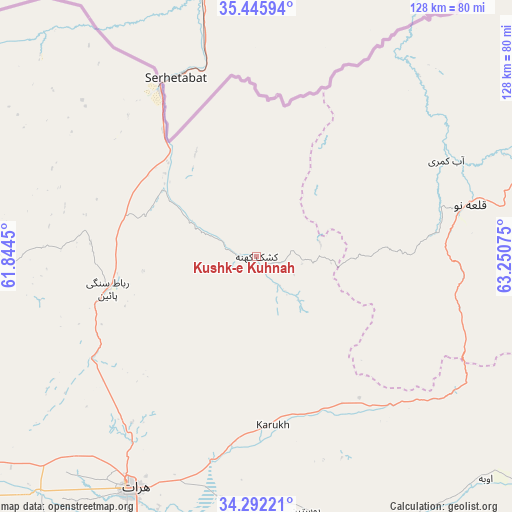
Kushk-e Kuhnah GPS coordinates[2]
34° 52' 15.96" North, 62° 32' 51.432" East
| Map corner | latitude | longitude |
|---|---|---|
| Upper-left | 35.44594°, | 61.8445° |
| Center: | 34.8711°, | 62.54762° |
| Lower-right: | 34.29221°, | 63.25075° |
| Map W x H: | 128.3×128.3 km | = 79.7×79.7mi |
| max Lat: | 38.4435° ⇑44.1% North |
| Kushk-e Kuhnah: | 34.8711° |
| min Lat: | ⇓55.9% South 30.15° |
| min Long | Kushk-e Kuhnah | max Long |
| 61.06667° | 62.54762° | 72.318° |
| W 6.8%⇐ | ⇒93.2% E |
Elevation
Elevation of Kushk-e Kuhnah is 1076 m = 3530 ft, and this is 342.4 m = 1123 ft below average elevation for this country.
| Max E: |
3068 m = 10066 ft | 62.7% |
| Avg. | 1418.4 m = 4654 ft | |
| Kushk-e Kuhnah | 1076 m = 3530 ft | |
Min E: |
254 m = 833 ft | 37.3% |
See also: Afghanistan elevation on elevation.city.
Geographical zone
Kushk-e Kuhnah is located in North temperate zone (between Tropic of Cancer and the Arctic Circle). Distance of this Northern Tropic circle is 1271.4 km =790 mi to South.| Distance of | km | miles | from Kushk-e Kuhnah |
|---|---|---|---|
| North Pole | 6129.8 | 3808.9 | to North |
| Arctic Circle | 3523.9 | 2189.6 | to North |
| Tropic Cancer | 1271.4 | 790 | to South |
| Equator | 3877.3 | 2409.2 | to South |


Nearby cities:
15 places around Kushk-e Kuhnah: (largest is in red/bold)
• Bala Murghab
106.4 km =66.1 mi,  41°
41°
• Chahār Burj
76.9 km =47.8 mi,  205°
205°
• Ghōriyān
112.9 km =70.2 mi,  238°
238°
• Guz̄arah
79.4 km =49.3 mi,  202°
202°
• Herāt
66.3 km =41.2 mi, 208°
• Injīl
69.1 km =42.9 mi, 203°
• Karukh
43.5 km =27 mi,  175°
175°
• Qala i Naw
54.5 km =33.9 mi,  76°
76°
• Qarah Bāgh
70.8 km =44 mi,  276°
276°
• Qaryeh-ye Owbeh
80.1 km =49.8 mi,  134°
134°
• Qādis
80.8 km =50.2 mi,  94°
94°
• Rabāţ-e Sangī-ye Pā’īn
38.1 km =23.7 mi,  257°
257°
• Sang Atesh
59 km =36.7 mi, 44°
• Zindah Jān
93.9 km =58.3 mi,  231°
231°
• Āb-e Kamarī
53.2 km =33.1 mi,  63°
63°
Sources, notices
• [Note1] Compared only with cities in Afghanistan existing in our database
• [Src1] Map data: © OpenStreetMap contributors (CC-BY-SA)
• [Src2] Other city data from geonames.org with taken over terms of usage.
• [Src3] Geographical zone / Annual Mean Temperature by Robert A. Rohde @ Wikipedia
