Sang Atesh geodata
Sang Atesh (Badghis) is a seat of a second-order administrative division; located in Afghanistan in Asia/Kabul (GMT+4.5) time zone. In our database, there are 93 cities with bigger population. Compared to other cities in Afghanistan, 65.3% of cities are located further ↓South; 91.6% of cities are located further →East and 83.9% of cities have higher elevation than Sang Atesh. Note1


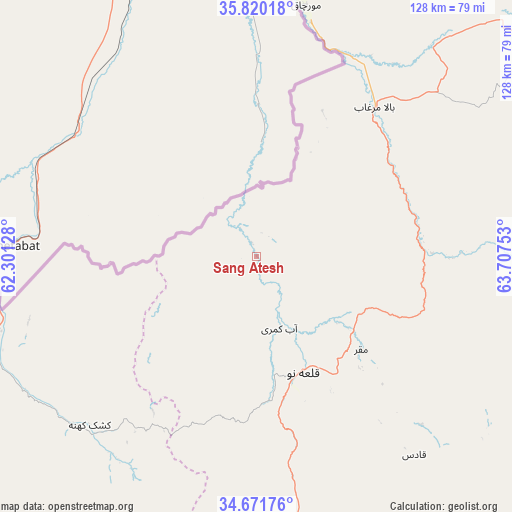
Sang Atesh GPS coordinates[2]
35° 14' 52.8" North, 63° 0' 15.84" East
| Map corner | latitude | longitude |
|---|---|---|
| Upper-left | 35.82018°, | 62.30128° |
| Center: | 35.248°, | 63.0044° |
| Lower-right: | 34.67176°, | 63.70753° |
| Map W x H: | 127.7×127.7 km | = 79.3×79.3mi |
| max Lat: | 38.4435° ⇑34.7% North |
| Sang Atesh: | 35.248° |
| min Lat: | ⇓65.3% South 30.15° |
| min Long | Sang Atesh | max Long |
| 61.06667° | 63.0044° | 72.318° |
| W 8.4%⇐ | ⇒91.6% E |
Elevation
Elevation of Sang Atesh is 634 m = 2080 ft, and this is 784.4 m = 2573 ft below average elevation for this country.
| Max E: |
3068 m = 10066 ft | 83.9% |
| Avg. | 1418.4 m = 4654 ft | |
| Sang Atesh | 634 m = 2080 ft | |
Min E: |
254 m = 833 ft | 16.1% |
See also: Afghanistan elevation on elevation.city.
Geographical zone
Sang Atesh is located in North temperate zone (between Tropic of Cancer and the Arctic Circle). Distance of this Northern Tropic circle is 1313.3 km =816 mi to South.| Distance of | km | miles | from Sang Atesh |
|---|---|---|---|
| North Pole | 6087.9 | 3782.8 | to North |
| Arctic Circle | 3482 | 2163.6 | to North |
| Tropic Cancer | 1313.3 | 816 | to South |
| Equator | 3919.2 | 2435.3 | to South |


Nearby cities:
15 places around Sang Atesh: (largest is in red/bold)
• Bala Murghab
47.5 km =29.5 mi,  38°
38°
• Chisht-e Sharīf
120.6 km =74.9 mi,  146°
146°
• Ghormach
88.6 km =55.1 mi,  52°
52°
• Herāt
124.1 km =77.1 mi,  216°
216°
• Injīl
126 km =78.3 mi,  213°
213°
• Jawand
106.1 km =65.9 mi,  101°
101°
• Karukh
93.4 km =58 mi,  204°
204°
• Kushk-e Kuhnah
59 km =36.7 mi, 224°
• Qala i Naw
31.1 km =19.3 mi,  158°
158°
• Qarah Bāgh
116.9 km =72.6 mi,  252°
252°
• Qaryeh-ye Owbeh
98.9 km =61.5 mi,  170°
170°
• Qādis
62.4 km =38.8 mi,  141°
141°
• Rabāţ-e Sangī-ye Pā’īn
93.2 km =57.9 mi,  237°
237°
• Sangalak-i-Kaisar
126.5 km =78.6 mi,  67°
67°
• Āb-e Kamarī
18.7 km =11.6 mi, 162°
Sources, notices
• [Note1] Compared only with cities in Afghanistan existing in our database
• [Src1] Map data: © OpenStreetMap contributors (CC-BY-SA)
• [Src2] Other city data from geonames.org with taken over terms of usage.
• [Src3] Geographical zone / Annual Mean Temperature by Robert A. Rohde @ Wikipedia
