Āb-e Kamarī geodata
Āb-e Kamarī (Badghis) is a seat of a second-order administrative division; located in Afghanistan in Asia/Kabul (GMT+4.5) time zone. In our database, there are 93 cities with bigger population. Compared to other cities in Afghanistan, 63% of cities are located further ↓South; 91.3% of cities are located further →East and 78.5% of cities have higher elevation than Āb-e Kamarī. Note1


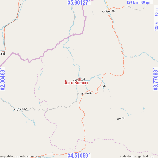
Āb-e Kamarī GPS coordinates[2]
35° 5' 16.656" North, 63° 4' 4.08" East
| Map corner | latitude | longitude |
|---|---|---|
| Upper-left | 35.66127°, | 62.36468° |
| Center: | 35.08796°, | 63.0678° |
| Lower-right: | 34.51059°, | 63.77093° |
| Map W x H: | 127.9×127.9 km | = 79.5×79.5mi |
| max Lat: | 38.4435° ⇑37% North |
| Āb-e Kamarī: | 35.08796° |
| min Lat: | ⇓63% South 30.15° |
| min Long | Āb-e Kamarī | max Long |
| 61.06667° | 63.0678° | 72.318° |
| W 8.7%⇐ | ⇒91.3% E |
Elevation
Elevation of Āb-e Kamarī is 760 m = 2493 ft, and this is 658.4 m = 2160 ft below average elevation for this country.
| Max E: |
3068 m = 10066 ft | 78.5% |
| Avg. | 1418.4 m = 4654 ft | |
| Āb-e Kamarī | 760 m = 2493 ft | |
Min E: |
254 m = 833 ft | 21.5% |
See also: Afghanistan elevation on elevation.city.
Geographical zone
Āb-e Kamarī is located in North temperate zone (between Tropic of Cancer and the Arctic Circle). Distance of this Northern Tropic circle is 1295.5 km =805 mi to South.| Distance of | km | miles | from Āb-e Kamarī |
|---|---|---|---|
| North Pole | 6105.6 | 3793.8 | to North |
| Arctic Circle | 3499.8 | 2174.7 | to North |
| Tropic Cancer | 1295.5 | 805 | to South |
| Equator | 3901.4 | 2424.2 | to South |


Nearby cities:
15 places around Āb-e Kamarī: (largest is in red/bold)
• Bala Murghab
60 km =37.3 mi,  23°
23°
• Chahār Burj
123.3 km =76.6 mi,  220°
220°
• Chisht-e Sharīf
102.7 km =63.8 mi,  143°
143°
• Ghormach
96.4 km =59.9 mi,  42°
42°
• Herāt
114.3 km =71 mi, 223°
• Injīl
115.3 km =71.6 mi, 220°
• Jawand
98.4 km =61.1 mi,  91°
91°
• Karukh
80.5 km =50 mi,  213°
213°
• Kushk-e Kuhnah
53.2 km =33.1 mi,  243°
243°
• Qala i Naw
12.5 km =7.8 mi,  153°
153°
• Qarah Bāgh
118.8 km =73.8 mi,  262°
262°
• Qaryeh-ye Owbeh
80.5 km =50 mi,  172°
172°
• Qādis
45.3 km =28.1 mi,  133°
133°
• Rabāţ-e Sangī-ye Pā’īn
90.5 km =56.2 mi,  249°
249°
• Sang Atesh
18.7 km =11.6 mi,  342°
342°
Sources, notices
• [Note1] Compared only with cities in Afghanistan existing in our database
• [Src1] Map data: © OpenStreetMap contributors (CC-BY-SA)
• [Src2] Other city data from geonames.org with taken over terms of usage.
• [Src3] Geographical zone / Annual Mean Temperature by Robert A. Rohde @ Wikipedia
