Qala i Naw geodata
Qala i Naw (Badghis) is a seat of a first-order administrative division; located in Afghanistan in Asia/Kabul (GMT+4.5) time zone. With population of 9,000 people, there are 75 cities with bigger population in this country. Compared to other cities in Afghanistan, 59.5% of cities are located further ↓South; 91% of cities are located further →East and 72% of cities have higher elevation than Qala i Naw. Note1


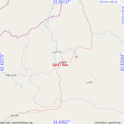
Qala i Naw GPS coordinates[2]
34° 59' 14.46" North, 63° 7' 44.076" East
| Map corner | latitude | longitude |
|---|---|---|
| Upper-left | 35.56137°, | 62.42579° |
| Center: | 34.98735°, | 63.12891° |
| Lower-right: | 34.40927°, | 63.83204° |
| Map W x H: | 128.1×128.1 km | = 79.6×79.6mi |
| max Lat: | 38.4435° ⇑40.5% North |
| Qala i Naw: | 34.98735° |
| min Lat: | ⇓59.5% South 30.15° |
| min Long | Qala i Naw | max Long |
| 61.06667° | 63.12891° | 72.318° |
| W 9%⇐ | ⇒91% E |
Elevation
Elevation of Qala i Naw is 887 m = 2910 ft, and this is 531.4 m = 1743 ft below average elevation for this country.
| Max E: |
3068 m = 10066 ft | 72% |
| Avg. | 1418.4 m = 4654 ft | |
| Qala i Naw | 887 m = 2910 ft | |
Min E: |
254 m = 833 ft | 28% |
See also: Afghanistan elevation on elevation.city.
Geographical zone
Qala i Naw is located in North temperate zone (between Tropic of Cancer and the Arctic Circle). Distance of this Northern Tropic circle is 1284.3 km =798 mi to South.| Distance of | km | miles | from Qala i Naw |
|---|---|---|---|
| North Pole | 6116.8 | 3800.8 | to North |
| Arctic Circle | 3510.9 | 2181.6 | to North |
| Tropic Cancer | 1284.3 | 798 | to South |
| Equator | 3890.2 | 2417.3 | to South |


Nearby cities:
15 places around Qala i Naw: (largest is in red/bold)
• Bala Murghab
68.8 km =42.8 mi,  15°
15°
• Chahār Burj
119.1 km =74 mi,  226°
226°
• Chisht-e Sharīf
90.5 km =56.2 mi,  141°
141°
• Ghormach
101.7 km =63.2 mi,  35°
35°
• Guz̄arah
120.3 km =74.8 mi,  224°
224°
• Herāt
110.8 km =68.8 mi, 230°
• Injīl
111 km =69 mi, 226°
• Jawand
93.3 km =58 mi,  84°
84°
• Karukh
75 km =46.6 mi, 221°
• Kushk-e Kuhnah
54.5 km =33.9 mi,  256°
256°
• Qaryeh-ye Owbeh
68.8 km =42.8 mi,  176°
176°
• Qādis
33.9 km =21.1 mi,  125°
125°
• Rabāţ-e Sangī-ye Pā’īn
92.6 km =57.5 mi, 256°
• Sang Atesh
31.1 km =19.3 mi,  338°
338°
• Āb-e Kamarī
12.5 km =7.8 mi,  333°
333°
Sources, notices
• [Note1] Compared only with cities in Afghanistan existing in our database
• [Src1] Map data: © OpenStreetMap contributors (CC-BY-SA)
• [Src2] Other city data from geonames.org with taken over terms of usage.
• [Src3] Geographical zone / Annual Mean Temperature by Robert A. Rohde @ Wikipedia
