‘Alāqahdārī Aṯghar geodata
‘Alāqahdārī Aṯghar (Zabul) is a seat of a second-order administrative division; located in Afghanistan in Asia/Kabul (GMT+4.5) time zone. In our database, there are 93 cities with bigger population. Compared to other cities in Afghanistan, 94.2% of cities are located further ↑North; 59.2% of cities are located further →East and 67.2% of cities have lower elevation than ‘Alāqahdārī Aṯghar. Note1


‘Alāqahdārī Aṯghar GPS coordinates[2]
31° 44' 6.216" North, 67° 21' 26.64" East
| Map corner | latitude | longitude |
|---|---|---|
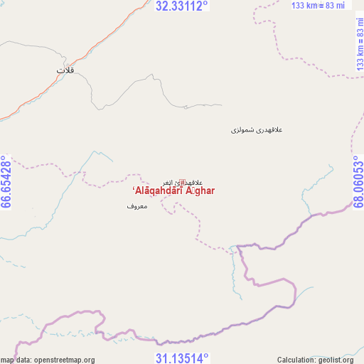
| Upper-left | 32.33112°, | 66.65428° |
| Center: | 31.73506°, | 67.3574° |
| Lower-right: | 31.13514°, | 68.06053° |
| Map W x H: | 133×133 km | = 82.6×82.6mi |
| max Lat: | 38.4435° ⇑94.2% North |
| ‘Alāqahdārī Aṯghar: | 31.73506° |
| min Lat: | ⇓5.8% South 30.15° |
| min Long | ‘Alāqahdār� | max Long |
| 61.06667° | 67.3574° | 72.318° |
| W 40.8%⇐ | ⇒59.2% E |
Elevation
Elevation of ‘Alāqahdārī Aṯghar is 1827 m = 5994 ft, and this is 408.6 m = 1341 ft above average elevation for this country.
| Max E: |
3068 m = 10066 ft | 32.8% |
| ‘Alāqahdārī Aṯghar | 1827 m 5994 ft | |
| Avg. | 1418.4 m = 4654 ft | |
Min E: |
254 m = 833 ft | 67.2% |
See also: Afghanistan elevation on elevation.city.
Geographical zone
‘Alāqahdārī Aṯghar is located in North temperate zone (between Tropic of Cancer and the Arctic Circle). Distance of this Northern Tropic circle is 922.7 km =573.3 mi to South.| Distance of | km | miles | from ‘Alāqahdārī Aṯghar |
|---|---|---|---|
| North Pole | 6478.5 | 4025.6 | to North |
| Arctic Circle | 3872.6 | 2406.3 | to North |
| Tropic Cancer | 922.7 | 573.3 | to South |
| Equator | 3528.6 | 2192.6 | to South |


Nearby cities:
15 places around ‘Alāqahdārī Aṯghar: (largest is in red/bold)
• Arghestān
84.5 km =52.5 mi,  256°
256°
• Khākirān
125.6 km =78 mi,  347°
347°
• Khōshāmand
134.3 km =83.5 mi,  38°
38°
• Khūgyāṉī
75.9 km =47.2 mi, 255°
• Muqêr
126.7 km =78.7 mi,  17°
17°
• Mīzān ‘Alāqahdārī
93.6 km =58.2 mi,  301°
301°
• Nāyak
108.1 km =67.2 mi,  329°
329°
• Qalāt
59.1 km =36.7 mi,  314°
314°
• Shahr-e Şafā
98 km =60.9 mi,  274°
274°
• Spīn Bōldak
121.8 km =75.7 mi,  228°
228°
• Sāyagaz
97.2 km =60.4 mi,  341°
341°
• Zamtō Kêlay
131.9 km =82 mi, 302°
• Ḩukūmat-e Shīnkaī
27.6 km =17.1 mi,  355°
355°
• ‘Alāqahdārī Gēlān
113.4 km =70.5 mi,  13°
13°
• ‘Alāqahdārī Shāh Jōy
87.6 km =54.4 mi,  3°
3°
Sources, notices
• [Note1] Compared only with cities in Afghanistan existing in our database
• [Src1] Map data: © OpenStreetMap contributors (CC-BY-SA)
• [Src2] Other city data from geonames.org with taken over terms of usage.
• [Src3] Geographical zone / Annual Mean Temperature by Robert A. Rohde @ Wikipedia
