Menongue geodata
Menongue (Cuando Cobango) is a seat of a first-order administrative division; located in Angola in Africa/Luanda (GMT+1) time zone. With population of 32,203 people, there are 14 cities with bigger population in this country. Compared to other cities in Angola, 91.7% of cities are located further ↑North; 80.6% of cities are located further ←West and 69.4% of cities have lower elevation than Menongue. Note1


Menongue GPS coordinates[2]
14° 39' 30.6" South, 17° 41' 27.564" East
| Map corner | latitude | longitude |
|---|---|---|
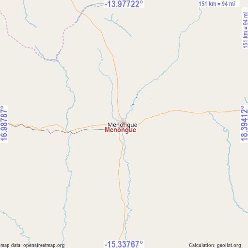
| Upper-left | -13.97722°, | 16.98787° |
| Center: | -14.6585°, | 17.69099° |
| Lower-right: | -15.33767°, | 18.39412° |
| Map W x H: | 151.3×151.3 km | = 94×94mi |
| max Lat: | -5.55° ⇑91.7% North |
| Menongue: | -14.6585° |
| min Lat: | ⇓8.3% South -17.06667° |
| min Long | Menongue | max Long |
| 12.15222° | 17.69099° | 22.22466° |
| W 80.6%⇐ | ⇒19.4% E |
Elevation
Elevation of Menongue is 1355 m = 4446 ft, and this is 386.1 m = 1267 ft above average elevation for this country.
| Max E: |
1895 m = 6217 ft | 30.6% |
| Menongue | 1355 m 4446 ft | |
| Avg. | 968.9 m = 3179 ft | |
Min E: |
1 m = 3 ft | 69.4% |
See also: Angola elevation on elevation.city.
Geographical zone
Menongue is located in South Torrid zone (between Equator and Tropic of Capricorn). Distance of this Southern Tropic circle is 976 km =606.5 mi to South.| Distance of | km | miles | from Menongue |
|---|---|---|---|
| Equator | 1629.9 | 1012.8 | to North |
| Tropic Capricorn | 976 | 606.5 | to South |
| Antarctic Circle | 5771.3 | 3586.1 | to South |
| South Pole | 8377.2 | 5205.3 | to South |


Nearby cities:
12 places around Menongue: (largest is in red/bold)
• Caconda
301 km =187 mi,  289°
289°
• Camacupa
294.6 km =183.1 mi,  355°
355°
• Catabola
282.4 km =175.5 mi,  351°
351°
• Caála
305.4 km =189.8 mi,  311°
311°
• Chela
358 km =222.5 mi,  317°
317°
• Chinjenje
348.9 km =216.8 mi,  303°
303°
• Chissamba
279.8 km =173.9 mi, 352°
• Cuito
265.9 km =165.2 mi,  342°
342°
• Huambo
297.1 km =184.6 mi, 314°
• Longonjo
327.5 km =203.5 mi, 306°
• Luena
400.3 km =248.7 mi,  36°
36°
• Ondjiva
339.9 km =211.2 mi,  218°
218°
Sources, notices
• [Note1] Compared only with cities in Angola existing in our database
• [Src1] Map data: © OpenStreetMap contributors (CC-BY-SA)
• [Src2] Other city data from geonames.org with taken over terms of usage.
• [Src3] Geographical zone / Annual Mean Temperature by Robert A. Rohde @ Wikipedia
