Longonjo geodata
Longonjo (Huambo) is a populated place; located in Angola in Africa/Luanda (GMT+1) time zone. With population of 24,346 people, there are 16 cities with bigger population in this country. Compared to other cities in Angola, 83.3% of cities are located further ↑North; 50% of cities are located further ←West and 75% of cities have lower elevation than Longonjo. Note1


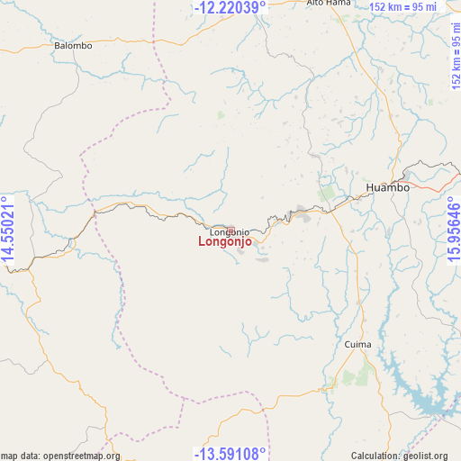
Longonjo GPS coordinates[2]
12° 54' 24.012" South, 15° 15' 11.988" East
| Map corner | latitude | longitude |
|---|---|---|
| Upper-left | -12.22039°, | 14.55021° |
| Center: | -12.90667°, | 15.25333° |
| Lower-right: | -13.59108°, | 15.95646° |
| Map W x H: | 152.4×152.4 km | = 94.7×94.7mi |
| max Lat: | -5.55° ⇑83.3% North |
| Longonjo: | -12.90667° |
| min Lat: | ⇓16.7% South -17.06667° |
| min Long | Longonjo | max Long |
| 12.15222° | 15.25333° | 22.22466° |
| W 50%⇐ | ⇒50% E |
Elevation
Elevation of Longonjo is 1424 m = 4672 ft, and this is 455.1 m = 1493 ft above average elevation for this country.
| Max E: |
1895 m = 6217 ft | 25% |
| Longonjo | 1424 m 4672 ft | |
| Avg. | 968.9 m = 3179 ft | |
Min E: |
1 m = 3 ft | 75% |
See also: Angola elevation on elevation.city.
Geographical zone
Longonjo is located in South Torrid zone (between Equator and Tropic of Capricorn). Distance of this Southern Tropic circle is 1170.8 km =727.5 mi to South.| Distance of | km | miles | from Longonjo |
|---|---|---|---|
| Equator | 1435.1 | 891.7 | to North |
| Tropic Capricorn | 1170.8 | 727.5 | to South |
| Antarctic Circle | 5966.1 | 3707.2 | to South |
| South Pole | 8572 | 5326.4 | to South |


Nearby cities:
15 places around Longonjo: (largest is in red/bold)
• Benguela
203.7 km =126.6 mi,  280°
280°
• Caconda
94.1 km =58.5 mi,  192°
192°
• Camacupa
261.6 km =162.6 mi,  67°
67°
• Catabola
235.9 km =146.6 mi, 69°
• Catumbela
192.6 km =119.7 mi,  285°
285°
• Caála
33.8 km =21 mi,  79°
79°
• Chela
70 km =43.5 mi,  16°
16°
• Chinjenje
28.4 km =17.6 mi,  264°
264°
• Chissamba
240.3 km =149.3 mi, 69°
• Cuito
191.3 km =118.9 mi, 72°
• Huambo
54.6 km =33.9 mi, 74°
• Lobito
195.8 km =121.7 mi, 287°
• Quibala
243.4 km =151.2 mi,  352°
352°
• Sumbe
243.4 km =151.2 mi,  320°
320°
• Uacu Cungo
173 km =107.5 mi,  355°
355°
Sources, notices
• [Note1] Compared only with cities in Angola existing in our database
• [Src1] Map data: © OpenStreetMap contributors (CC-BY-SA)
• [Src2] Other city data from geonames.org with taken over terms of usage.
• [Src3] Geographical zone / Annual Mean Temperature by Robert A. Rohde @ Wikipedia
