Streaky Bay geodata
Streaky Bay (South Australia) is a populated place; located in Australia in Australia/Adelaide (GMT+10.5) time zone. With population of 1,449 people, there are 3321 cities with bigger population in this country. Compared to other cities in Australia, 59.8% of cities are located further ↓South; 86.4% of cities are located further →East and 85% of cities have higher elevation than Streaky Bay. Note1


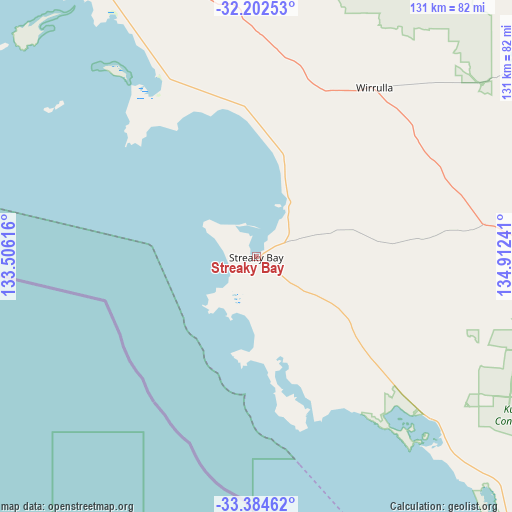
Streaky Bay GPS coordinates[2]
32° 47' 43.944" South, 134° 12' 33.408" East
| Map corner | latitude | longitude |
|---|---|---|
| Upper-left | -32.20253°, | 133.50616° |
| Center: | -32.79554°, | 134.20928° |
| Lower-right: | -33.38462°, | 134.91241° |
| Map W x H: | 131.4×131.4 km | = 81.6×81.6mi |
| max Lat: | -10.58257° ⇑40.2% North |
| Streaky Bay: | -32.79554° |
| min Lat: | ⇓59.8% South -43.31423° |
| min Long | Streaky Bay | max Long |
| 113.53327° | 134.20928° | 153.61246° |
| W 13.6%⇐ | ⇒86.4% E |
Elevation
Elevation of Streaky Bay is 12 m = 39 ft, and this is 110 m = 361 ft below average elevation for this country.
| Max E: |
1715 m = 5627 ft | 85% |
| Avg. | 122 m = 400 ft | |
| Streaky Bay | 12 m = 39 ft | |
Min E: |
-2 m = -7 ft | 15% |
See also: Australia elevation on elevation.city.
Geographical zone
Streaky Bay is located in South temperate zone (between Tropic of Capricorn and the Antarctic Circle). Distance of this Southern Tropic circle is 1040.6 km =646.6 mi to North.| Distance of | km | miles | from Streaky Bay |
|---|---|---|---|
| Equator | 3646.5 | 2265.8 | to North |
| Tropic Capricorn | 1040.6 | 646.6 | to North |
| Antarctic Circle | 3754.7 | 2333.1 | to South |
| South Pole | 6360.5 | 3952.2 | to South |


Nearby cities:
15 places around Streaky Bay: (largest is in red/bold)
• Arno Bay
251 km =156 mi,  119°
119°
• Ceduna
89.8 km =55.8 mi,  325°
325°
• Cleve
235.5 km =146.3 mi, 115°
• Coffin Bay
223.5 km =138.9 mi,  152°
152°
• Cowell
270.8 km =168.3 mi,  111°
111°
• Cummins
215.4 km =133.8 mi,  139°
139°
• Kimba
209.7 km =130.3 mi,  100°
100°
• Port Lincoln
264.1 km =164.1 mi, 144°
• Smoky Bay
53.1 km =33 mi, 330°
• Thevenard
89.4 km =55.6 mi,  323°
323°
• Tumby Bay
248.2 km =154.2 mi, 135°
• Whyalla Jenkins
309.4 km =192.3 mi,  94°
94°
• Whyalla Norrie
311.9 km =193.8 mi, 94°
• Whyalla Stuart
310.5 km =192.9 mi, 94°
• Wudinna
120.5 km =74.9 mi, 103°
Sources, notices
• [Note1] Compared only with cities in Australia existing in our database
• [Src1] Map data: © OpenStreetMap contributors (CC-BY-SA)
• [Src2] Other city data from geonames.org with taken over terms of usage.
• [Src3] Geographical zone / Annual Mean Temperature by Robert A. Rohde @ Wikipedia
