Port Lincoln geodata
Port Lincoln (South Australia) is a populated place; located in Australia in Australia/Adelaide (GMT+10.5) time zone. With population of 13,810 people, there are 322 cities with bigger population in this country. Compared to other cities in Australia, 65% of cities are located further ↑North; 86.1% of cities are located further →East and 60% of cities have higher elevation than Port Lincoln. Note1


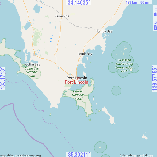
Port Lincoln GPS coordinates[2]
34° 43' 34.5" South, 135° 52' 27.912" East
| Map corner | latitude | longitude |
|---|---|---|
| Upper-left | -34.14635°, | 135.1713° |
| Center: | -34.72625°, | 135.87442° |
| Lower-right: | -35.30211°, | 136.57755° |
| Map W x H: | 128.5×128.5 km | = 79.8×79.8mi |
| max Lat: | -10.58257° ⇑65% North |
| Port Lincoln: | -34.72625° |
| min Lat: | ⇓35% South -43.31423° |
| min Long | Port Lincoln | max Long |
| 113.53327° | 135.87442° | 153.61246° |
| W 13.9%⇐ | ⇒86.1% E |
Elevation
Elevation of Port Lincoln is 32 m = 105 ft, and this is 90 m = 295 ft below average elevation for this country.
| Max E: |
1715 m = 5627 ft | 60% |
| Avg. | 122 m = 400 ft | |
| Port Lincoln | 32 m = 105 ft | |
Min E: |
-2 m = -7 ft | 40% |
See also: Australia elevation on elevation.city.
Geographical zone
Port Lincoln is located in South temperate zone (between Tropic of Capricorn and the Antarctic Circle). Distance of this Southern Tropic circle is 1255.3 km =780 mi to North.| Distance of | km | miles | from Port Lincoln |
|---|---|---|---|
| Equator | 3861.2 | 2399.2 | to North |
| Tropic Capricorn | 1255.3 | 780 | to North |
| Antarctic Circle | 3540 | 2199.7 | to South |
| South Pole | 6145.9 | 3818.9 | to South |


Nearby cities:
15 places around Port Lincoln: (largest is in red/bold)
• Arno Bay
111.7 km =69.4 mi,  34°
34°
• Cleve
127.8 km =79.4 mi, 26°
• Coffin Bay
53.2 km =33.1 mi,  287°
287°
• Cowell
150.8 km =93.7 mi,  39°
39°
• Cummins
53.2 km =33.1 mi,  345°
345°
• Honiton
167.6 km =104.1 mi,  105°
105°
• Maitland
169.3 km =105.2 mi,  76°
76°
• Minlaton
157.3 km =97.7 mi,  91°
91°
• Moonta
173.6 km =107.9 mi,  65°
65°
• Moonta Bay
172.5 km =107.2 mi,  64°
64°
• North Moonta
174.6 km =108.5 mi, 64°
• Port Hughes
169.5 km =105.3 mi, 65°
• Stansbury
176.9 km =109.9 mi,  96°
96°
• Tumby Bay
44 km =27.3 mi, 28°
• Yorketown
161.2 km =100.2 mi, 101°
Sources, notices
• [Note1] Compared only with cities in Australia existing in our database
• [Src1] Map data: © OpenStreetMap contributors (CC-BY-SA)
• [Src2] Other city data from geonames.org with taken over terms of usage.
• [Src3] Geographical zone / Annual Mean Temperature by Robert A. Rohde @ Wikipedia
