Cooks Gap geodata
Cooks Gap (New South Wales) is a section of populated place; located in Australia in Australia/Sydney (GMT+11) time zone. With population of 516 people, there are 4827 cities with bigger population in this country. Compared to other cities in Australia, 62.1% of cities are located further ↓South; 56.5% of cities are located further ←West and 95.4% of cities have lower elevation than Cooks Gap. Note1


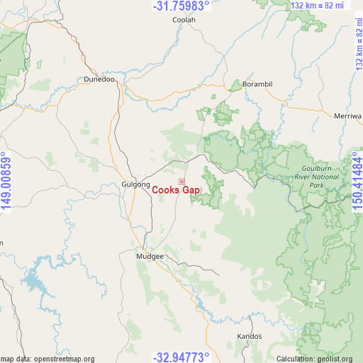
Cooks Gap GPS coordinates[2]
32° 21' 20.628" South, 149° 42' 42.156" East
| Map corner | latitude | longitude |
|---|---|---|
| Upper-left | -31.75983°, | 149.00859° |
| Center: | -32.35573°, | 149.71171° |
| Lower-right: | -32.94773°, | 150.41484° |
| Map W x H: | 132.1×132.1 km | = 82.1×82.1mi |
| max Lat: | -10.58257° ⇑37.9% North |
| Cooks Gap: | -32.35573° |
| min Lat: | ⇓62.1% South -43.31423° |
| min Long | Cooks Gap | max Long |
| 113.53327° | 149.71171° | 153.61246° |
| W 56.5%⇐ | ⇒43.5% E |
Elevation
Elevation of Cooks Gap is 590 m = 1936 ft, and this is 468 m = 1535 ft above average elevation for this country.
| Max E: |
1715 m = 5627 ft | 4.6% |
| Cooks Gap | 590 m 1936 ft | |
| Avg. | 122 m = 400 ft | |
Min E: |
-2 m = -7 ft | 95.4% |
See also: Australia elevation on elevation.city.
Geographical zone
Cooks Gap is located in South temperate zone (between Tropic of Capricorn and the Antarctic Circle). Distance of this Southern Tropic circle is 991.7 km =616.2 mi to North.| Distance of | km | miles | from Cooks Gap |
|---|---|---|---|
| Equator | 3597.6 | 2235.4 | to North |
| Tropic Capricorn | 991.7 | 616.2 | to North |
| Antarctic Circle | 3803.6 | 2363.4 | to South |
| South Pole | 6409.4 | 3982.6 | to South |


Nearby cities:
15 places around Cooks Gap: (largest is in red/bold)
• Binnaway
94.7 km =58.8 mi,  340°
340°
• Coolah
58.7 km =36.5 mi,  0°
0°
• Denman
91.9 km =57.1 mi,  92°
92°
• Dunedoo
48.6 km =30.2 mi,  321°
321°
• Geurie
82.9 km =51.5 mi,  266°
266°
• Gulgong
16.9 km =10.5 mi, 267°
• Kandos
60.8 km =37.8 mi,  156°
156°
• Mendooran
81.2 km =50.5 mi, 316°
• Merriwa
65.2 km =40.5 mi,  68°
68°
• Montefiores
75.7 km =47 mi,  254°
254°
• Mudgee
29 km =18 mi,  203°
203°
• Rylstone
54.9 km =34.1 mi,  153°
153°
• Wellington
75.3 km =46.8 mi, 252°
• Wongarbon
89.5 km =55.6 mi, 271°
• Wuuluman
62.8 km =39 mi, 249°
Sources, notices
• [Note1] Compared only with cities in Australia existing in our database
• [Src1] Map data: © OpenStreetMap contributors (CC-BY-SA)
• [Src2] Other city data from geonames.org with taken over terms of usage.
• [Src3] Geographical zone / Annual Mean Temperature by Robert A. Rohde @ Wikipedia
