İstisu geodata
İstisu (Kalbajar) is a abandoned populated place; located in Azerbaijan in Asia/Baku (GMT+4) time zone. With population of 929 people, there are 174 cities with bigger population in this country. Compared to other cities in Azerbaijan, 69.2% of cities are located further ↑North; 83.2% of cities are located further →East and 100% of cities have lower elevation than İstisu. Note1


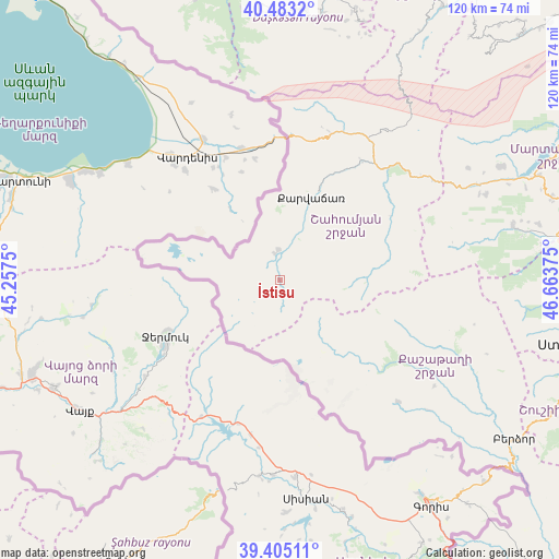
İstisu GPS coordinates[2]
39° 56' 46.608" North, 45° 57' 38.232" East
| Map corner | latitude | longitude |
|---|---|---|
| Upper-left | 40.4832°, | 45.2575° |
| Center: | 39.94628°, | 45.96062° |
| Lower-right: | 39.40511°, | 46.66375° |
| Map W x H: | 119.9×119.9 km | = 74.5×74.5mi |
| max Lat: | 41.75259° ⇑69.2% North |
| İstisu: | 39.94628° |
| min Lat: | ⇓30.8% South 38.45598° |
| min Long | İstisu | max Long |
| 44.84846° | 45.96062° | 50.84003° |
| W 16.8%⇐ | ⇒83.2% E |
Elevation
Elevation of İstisu is 2211 m = 7254 ft, and this is 1828 m = 5997 ft above average elevation for this country.
| Max E: |
2211 m = 7254 ft | 0% |
| İstisu | 2211 m 7254 ft | |
| Avg. | 383 m = 1257 ft | |
Min E: |
-26 m = -85 ft | 100% |
See also: Azerbaijan elevation on elevation.city.
Geographical zone
İstisu is located in North temperate zone (between Tropic of Cancer and the Arctic Circle). Distance of this Northern Tropic circle is 1835.7 km =1140.7 mi to South.| Distance of | km | miles | from İstisu |
|---|---|---|---|
| North Pole | 5565.5 | 3458.2 | to North |
| Arctic Circle | 2959.6 | 1839 | to North |
| Tropic Cancer | 1835.7 | 1140.7 | to South |
| Equator | 4441.6 | 2759.9 | to South |


Nearby cities:
15 places around İstisu: (largest is in red/bold)
• Alunitdağ
65.3 km =40.6 mi,  6°
6°
• Arafsa
74 km =46 mi,  191°
191°
• Arıqdam
73.2 km =45.5 mi,  349°
349°
• Arıqıran
72.2 km =44.9 mi,  335°
335°
• Askyaran
74.3 km =46.2 mi,  90°
90°
• Kerbakhiar
19.5 km =12.1 mi,  21°
21°
• Kyadabek
70.5 km =43.8 mi, 349°
• Laçın
63.5 km =39.5 mi,  127°
127°
• Shushi
70.5 km =43.8 mi,  107°
107°
• Vank
51.1 km =31.8 mi,  76°
76°
• Verkhniy Dashkesan
61.6 km =38.3 mi, 8°
• Xankandi
69.1 km =42.9 mi,  101°
101°
• Xocalı
70.8 km =44 mi, 92°
• Yukhary-Dashkesan
65 km =40.4 mi, 9°
• Şahbuz
68.5 km =42.6 mi,  208°
208°
Sources, notices
• [Note1] Compared only with cities in Azerbaijan existing in our database
• [Src1] Map data: © OpenStreetMap contributors (CC-BY-SA)
• [Src2] Other city data from geonames.org with taken over terms of usage.
• [Src3] Geographical zone / Annual Mean Temperature by Robert A. Rohde @ Wikipedia
