Kerbakhiar geodata
Kerbakhiar (Kalbajar) is a seat of a first-order administrative division; located in Azerbaijan in Asia/Baku (GMT+4) time zone. With population of 8,400 people, there are 84 cities with bigger population in this country. Compared to other cities in Azerbaijan, 64.3% of cities are located further ↑North; 80.5% of cities are located further →East and 97.3% of cities have lower elevation than Kerbakhiar. Note1


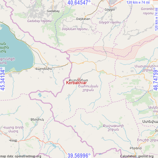
Kerbakhiar GPS coordinates[2]
40° 6' 35.424" North, 46° 2' 40.056" East
| Map corner | latitude | longitude |
|---|---|---|
| Upper-left | 40.64547°, | 45.34134° |
| Center: | 40.10984°, | 46.04446° |
| Lower-right: | 39.56996°, | 46.74759° |
| Map W x H: | 119.6×119.6 km | = 74.3×74.3mi |
| max Lat: | 41.75259° ⇑64.3% North |
| Kerbakhiar: | 40.10984° |
| min Lat: | ⇓35.7% South 38.45598° |
| min Long | Kerbakhiar | max Long |
| 44.84846° | 46.04446° | 50.84003° |
| W 19.5%⇐ | ⇒80.5% E |
Elevation
Elevation of Kerbakhiar is 1555 m = 5102 ft, and this is 1172 m = 3845 ft above average elevation for this country.
| Max E: |
2211 m = 7254 ft | 2.7% |
| Kerbakhiar | 1555 m 5102 ft | |
| Avg. | 383 m = 1257 ft | |
Min E: |
-26 m = -85 ft | 97.3% |
See also: Azerbaijan elevation on elevation.city.
Geographical zone
Kerbakhiar is located in North temperate zone (between Tropic of Cancer and the Arctic Circle). Distance of this Northern Tropic circle is 1853.9 km =1152 mi to South.| Distance of | km | miles | from Kerbakhiar |
|---|---|---|---|
| North Pole | 5547.3 | 3446.9 | to North |
| Arctic Circle | 2941.4 | 1827.7 | to North |
| Tropic Cancer | 1853.9 | 1152 | to South |
| Equator | 4459.8 | 2771.2 | to South |


Nearby cities:
15 places around Kerbakhiar: (largest is in red/bold)
• Alunitdağ
46.7 km =29 mi,  0°
0°
• Arıqdam
57.6 km =35.8 mi,  338°
338°
• Arıqıran
60.1 km =37.3 mi,  322°
322°
• Böyük Qaramurad
62.3 km =38.7 mi,  326°
326°
• Ganja
69.1 km =42.9 mi,  22°
22°
• Kyadabek
54.9 km =34.1 mi, 338°
• Martakert
67 km =41.6 mi,  80°
80°
• Novosaratovka
66 km =41 mi, 325°
• Vank
43 km =26.7 mi,  98°
98°
• Verkhniy Dashkesan
42.7 km =26.5 mi, 3°
• Xankandi
68.6 km =42.6 mi,  118°
118°
• Xocalı
67.2 km =41.8 mi,  109°
109°
• Yelenendorf
57.8 km =35.9 mi, 23°
• Yukhary-Dashkesan
46.2 km =28.7 mi, 3°
• İstisu
19.5 km =12.1 mi,  201°
201°
Sources, notices
• [Note1] Compared only with cities in Azerbaijan existing in our database
• [Src1] Map data: © OpenStreetMap contributors (CC-BY-SA)
• [Src2] Other city data from geonames.org with taken over terms of usage.
• [Src3] Geographical zone / Annual Mean Temperature by Robert A. Rohde @ Wikipedia
