Xaçmaz geodata
Xaçmaz is a seat of a first-order administrative division; located in Azerbaijan in Asia/Baku (GMT+4) time zone. With population of 37,175 people, there are 18 cities with bigger population in this country. Compared to other cities in Azerbaijan, 94.6% of cities are located further ↓South; 67.6% of cities are located further ←West and 60% of cities have higher elevation than Xaçmaz. Note1


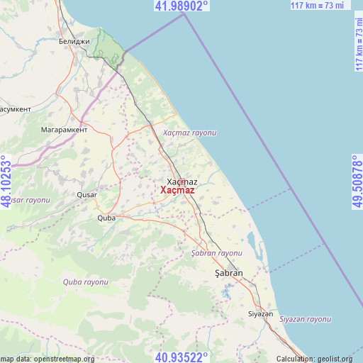
Xaçmaz GPS coordinates[2]
41° 27' 51.336" North, 48° 48' 20.34" East
| Map corner | latitude | longitude |
|---|---|---|
| Upper-left | 41.98902°, | 48.10253° |
| Center: | 41.46426°, | 48.80565° |
| Lower-right: | 40.93522°, | 49.50878° |
| Map W x H: | 117.2×117.2 km | = 72.8×72.8mi |
| max Lat: | 41.75259° ⇑5.4% North |
| Xaçmaz: | 41.46426° |
| min Lat: | ⇓94.6% South 38.45598° |
| min Long | Xaçmaz | max Long |
| 44.84846° | 48.80565° | 50.84003° |
| W 67.6%⇐ | ⇒32.4% E |
Elevation
Elevation of Xaçmaz is 47 m = 154 ft, and this is 336 m = 1102 ft below average elevation for this country.
| Max E: |
2211 m = 7254 ft | 60% |
| Avg. | 383 m = 1257 ft | |
| Xaçmaz | 47 m = 154 ft | |
Min E: |
-26 m = -85 ft | 40% |
See also: Azerbaijan elevation on elevation.city.
Geographical zone
Xaçmaz is located in North temperate zone (between Tropic of Cancer and the Arctic Circle). Distance of this Northern Tropic circle is 2004.5 km =1245.5 mi to South.| Distance of | km | miles | from Xaçmaz |
|---|---|---|---|
| North Pole | 5396.7 | 3353.4 | to North |
| Arctic Circle | 2790.8 | 1734.1 | to North |
| Tropic Cancer | 2004.5 | 1245.5 | to South |
| Equator | 4610.4 | 2864.8 | to South |


Nearby cities:
15 places around Xaçmaz: (largest is in red/bold)
• Altıağac
68.3 km =42.4 mi,  170°
170°
• Basqal
86.2 km =53.6 mi,  203°
203°
• Divichibazar
32.9 km =20.4 mi,  152°
152°
• Gilgilçay
43.3 km =26.9 mi, 146°
• Hacıhüseynli
13.1 km =8.1 mi,  266°
266°
• Khyzy
65.8 km =40.9 mi,  159°
159°
• Kilyazi
79.6 km =49.5 mi, 145°
• Kyzyl-Burun
50.1 km =31.1 mi, 148°
• Lahıc
77.3 km =48 mi,  207°
207°
• Quba
26.9 km =16.7 mi,  244°
244°
• Qusar
31.6 km =19.6 mi,  262°
262°
• Samur
36.7 km =22.8 mi,  301°
301°
• Xudat
21.2 km =13.2 mi,  330°
330°
• İsmayıllı
93.3 km =58 mi,  215°
215°
• Şuraabad
90.6 km =56.3 mi,  142°
142°
Sources, notices
• [Note1] Compared only with cities in Azerbaijan existing in our database
• [Src1] Map data: © OpenStreetMap contributors (CC-BY-SA)
• [Src2] Other city data from geonames.org with taken over terms of usage.
• [Src3] Geographical zone / Annual Mean Temperature by Robert A. Rohde @ Wikipedia
