Hacıhüseynli geodata
Hacıhüseynli (Quba) is a populated place; located in Azerbaijan in Asia/Baku (GMT+4) time zone. With population of 1,731 people, there are 154 cities with bigger population in this country. Compared to other cities in Azerbaijan, 94.1% of cities are located further ↓South; 64.3% of cities are located further ←West and 55.1% of cities have lower elevation than Hacıhüseynli. Note1


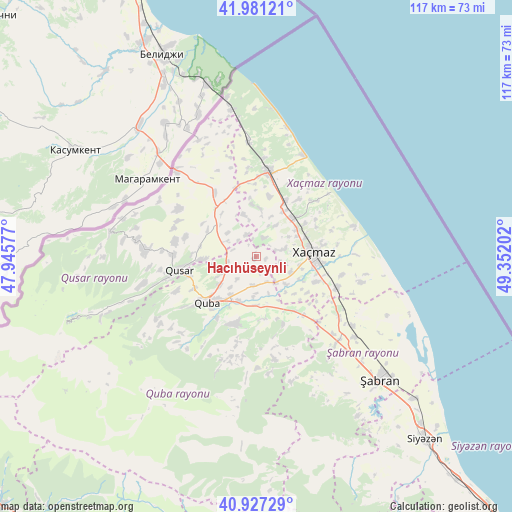
Hacıhüseynli GPS coordinates[2]
41° 27' 23.004" North, 48° 38' 56.004" East
| Map corner | latitude | longitude |
|---|---|---|
| Upper-left | 41.98121°, | 47.94577° |
| Center: | 41.45639°, | 48.64889° |
| Lower-right: | 40.92729°, | 49.35202° |
| Map W x H: | 117.2×117.2 km | = 72.8×72.8mi |
| max Lat: | 41.75259° ⇑5.9% North |
| Hacıhüseynli: | 41.45639° |
| min Lat: | ⇓94.1% South 38.45598° |
| min Long | Hacıhüseynli | max Long |
| 44.84846° | 48.64889° | 50.84003° |
| W 64.3%⇐ | ⇒35.7% E |
Elevation
Elevation of Hacıhüseynli is 258 m = 846 ft, and this is 125 m = 410 ft below average elevation for this country.
| Max E: |
2211 m = 7254 ft | 44.9% |
| Avg. | 383 m = 1257 ft | |
| Hacıhüseynli | 258 m = 846 ft | |
Min E: |
-26 m = -85 ft | 55.1% |
See also: Azerbaijan elevation on elevation.city.
Geographical zone
Hacıhüseynli is located in North temperate zone (between Tropic of Cancer and the Arctic Circle). Distance of this Northern Tropic circle is 2003.6 km =1245 mi to South.| Distance of | km | miles | from Hacıhüseynli |
|---|---|---|---|
| North Pole | 5397.5 | 3353.8 | to North |
| Arctic Circle | 2791.7 | 1734.7 | to North |
| Tropic Cancer | 2003.6 | 1245 | to South |
| Equator | 4609.5 | 2864.2 | to South |


Nearby cities:
15 places around Hacıhüseynli: (largest is in red/bold)
• Altıağac
70.7 km =43.9 mi,  160°
160°
• Basqal
80.9 km =50.3 mi,  195°
195°
• Divichibazar
40 km =24.9 mi,  135°
135°
• Gilgilçay
51 km =31.7 mi,  133°
133°
• Khyzy
70.6 km =43.9 mi,  149°
149°
• Kilyazi
87 km =54.1 mi, 138°
• Kyzyl-Burun
57.4 km =35.7 mi, 137°
• Lahıc
71.4 km =44.4 mi, 198°
• Quba
15.5 km =9.6 mi,  226°
226°
• Qusar
18.5 km =11.5 mi,  260°
260°
• Qutqashen
85.2 km =52.9 mi, 231°
• Samur
27.1 km =16.8 mi,  317°
317°
• Xaçmaz
13.1 km =8.1 mi,  86°
86°
• Xudat
19.6 km =12.2 mi,  8°
8°
• İsmayıllı
85.5 km =53.1 mi,  209°
209°
Sources, notices
• [Note1] Compared only with cities in Azerbaijan existing in our database
• [Src1] Map data: © OpenStreetMap contributors (CC-BY-SA)
• [Src2] Other city data from geonames.org with taken over terms of usage.
• [Src3] Geographical zone / Annual Mean Temperature by Robert A. Rohde @ Wikipedia
