Gilgilçay geodata
Gilgilçay (Siyǝzǝn) is a populated place; located in Azerbaijan in Asia/Baku (GMT+4) time zone. With population of 1,147 people, there are 167 cities with bigger population in this country. Compared to other cities in Azerbaijan, 88.6% of cities are located further ↓South; 74.1% of cities are located further ←West and 66.5% of cities have higher elevation than Gilgilçay. Note1


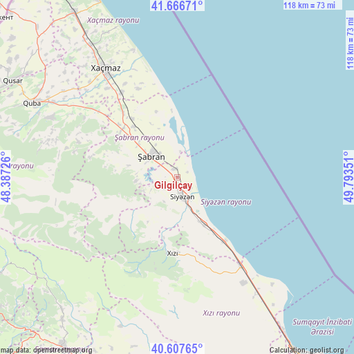
Gilgilçay GPS coordinates[2]
41° 8' 21.552" North, 49° 5' 25.368" East
| Map corner | latitude | longitude |
|---|---|---|
| Upper-left | 41.66671°, | 48.38726° |
| Center: | 41.13932°, | 49.09038° |
| Lower-right: | 40.60765°, | 49.79351° |
| Map W x H: | 117.8×117.8 km | = 73.2×73.2mi |
| max Lat: | 41.75259° ⇑11.4% North |
| Gilgilçay: | 41.13932° |
| min Lat: | ⇓88.6% South 38.45598° |
| min Long | Gilgilçay | max Long |
| 44.84846° | 49.09038° | 50.84003° |
| W 74.1%⇐ | ⇒25.9% E |
Elevation
Elevation of Gilgilçay is 29 m = 95 ft, and this is 354 m = 1161 ft below average elevation for this country.
| Max E: |
2211 m = 7254 ft | 66.5% |
| Avg. | 383 m = 1257 ft | |
| Gilgilçay | 29 m = 95 ft | |
Min E: |
-26 m = -85 ft | 33.5% |
See also: Azerbaijan elevation on elevation.city.
Geographical zone
Gilgilçay is located in North temperate zone (between Tropic of Cancer and the Arctic Circle). Distance of this Northern Tropic circle is 1968.3 km =1223 mi to South.| Distance of | km | miles | from Gilgilçay |
|---|---|---|---|
| North Pole | 5432.8 | 3375.8 | to North |
| Arctic Circle | 2826.9 | 1756.6 | to North |
| Tropic Cancer | 1968.3 | 1223 | to South |
| Equator | 4574.3 | 2842.3 | to South |


Nearby cities:
15 places around Gilgilçay: (largest is in red/bold)
• Altıağac
33.9 km =21.1 mi,  202°
202°
• Divichibazar
11 km =6.8 mi,  308°
308°
• Hacı Zeynalabdin
69.6 km =43.2 mi,  145°
145°
• Hacıhüseynli
51 km =31.7 mi, 313°
• Khyzy
25.7 km =16 mi,  182°
182°
• Kilyazi
36.4 km =22.6 mi,  144°
144°
• Kyzyl-Burun
7.1 km =4.4 mi,  162°
162°
• Lahıc
67.8 km =42.1 mi,  241°
241°
• Qobustan
68.7 km =42.7 mi,  191°
191°
• Quba
54.2 km =33.7 mi,  297°
297°
• Qusar
63.8 km =39.6 mi, 300°
• Shamakhi
67.9 km =42.2 mi,  213°
213°
• Xaçmaz
43.3 km =26.9 mi,  326°
326°
• Xudat
64.4 km =40 mi, 328°
• Şuraabad
47.6 km =29.6 mi, 138°
Sources, notices
• [Note1] Compared only with cities in Azerbaijan existing in our database
• [Src1] Map data: © OpenStreetMap contributors (CC-BY-SA)
• [Src2] Other city data from geonames.org with taken over terms of usage.
• [Src3] Geographical zone / Annual Mean Temperature by Robert A. Rohde @ Wikipedia
