Zoutleeuw geodata
Zoutleeuw (Flanders) is a populated place; located in Belgium in Europe/Brussels (GMT+2) time zone. With population of 7,897 people, there are 371 cities with bigger population in this country. Compared to other cities in Belgium, 52.5% of cities are located further ↓South; 70% of cities are located further ←West and 62.3% of cities have higher elevation than Zoutleeuw. Note1
Administrative division(s):
- Level 1: Flanders
- Level 2: Provincie Vlaams-Brabant
- Level 3: Arrondissement Leuven
- Level 4: Zoutleeuw


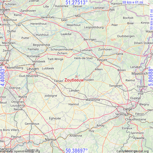
Zoutleeuw GPS coordinates[2]
50° 49' 59.376" North, 5° 6' 13.536" East
| Map corner | latitude | longitude |
|---|---|---|
| Upper-left | 51.27513°, | 4.40063° |
| Center: | 50.83316°, | 5.10376° |
| Lower-right: | 50.38697°, | 5.80688° |
| Map W x H: | 98.8×98.8 km | = 61.4×61.4mi |
| max Lat: | 51.46791° ⇑47.5% North |
| Zoutleeuw: | 50.83316° |
| min Lat: | ⇓52.5% South 49.53771° |
| min Long | Zoutleeuw | max Long |
| 2.59368° | 5.10376° | 6.25749° |
| W 70%⇐ | ⇒30% E |
Elevation
Elevation of Zoutleeuw is 30 m = 98 ft, and this is 69.5 m = 228 ft below average elevation for this country.
| Max E: |
582 m = 1909 ft | 62.3% |
| Avg. | 99.5 m = 326 ft | |
| Zoutleeuw | 30 m = 98 ft | |
Min E: |
1 m = 3 ft | 37.7% |
See also: Belgium elevation on elevation.city.
Geographical zone
Zoutleeuw is located in North temperate zone (between Tropic of Cancer and the Arctic Circle). Distance of this North polar circle is 1749.1 km =1086.8 mi to North.| Distance of | km | miles | from Zoutleeuw |
|---|---|---|---|
| North Pole | 4354.9 | 2706 | to North |
| Arctic Circle | 1749.1 | 1086.8 | to North |
| Tropic Cancer | 3046.2 | 1892.8 | to South |
| Equator | 5652.1 | 3512.1 | to South |


Nearby cities:
15 places around Zoutleeuw: (largest is in red/bold)
• Alken
14.9 km =9.3 mi,  71°
71°
• Bekkevoort
15.2 km =9.4 mi,  321°
321°
• Geetbets
6.8 km =4.2 mi,  4°
4°
• Gingelom
9.7 km =6 mi,  167°
167°
• Glabbeek
11.3 km =7 mi,  292°
292°
• Halen
12.8 km =8 mi, 2°
• Herk-de-Stad
12.7 km =7.9 mi,  20°
20°
• Kortenaken
8.9 km =5.5 mi,  339°
339°
• Landen
9.1 km =5.7 mi,  189°
189°
• Lincent
14.3 km =8.9 mi,  199°
199°
• Nieuwerkerken
7.2 km =4.5 mi,  61°
61°
• Sint-Joris
12.5 km =7.8 mi, 70°
• Sint-Truiden
6.1 km =3.8 mi,  107°
107°
• Terkoest
14.1 km =8.8 mi, 59°
• Tienen
12 km =7.5 mi,  256°
256°
Sources, notices
• [Note1] Compared only with cities in Belgium existing in our database
• [Src1] Map data: © OpenStreetMap contributors (CC-BY-SA)
• [Src2] Other city data from geonames.org with taken over terms of usage.
• [Src3] Geographical zone / Annual Mean Temperature by Robert A. Rohde @ Wikipedia
