Glabbeek geodata
Glabbeek (Flanders) is a populated place; located in Belgium in Europe/Brussels (GMT+2) time zone. With population of 5,070 people, there are 451 cities with bigger population in this country. Compared to other cities in Belgium, 57.2% of cities are located further ↓South; 64.1% of cities are located further ←West and 50.2% of cities have lower elevation than Glabbeek. Note1
Administrative division(s):
- Level 1: Flanders
- Level 2: Provincie Vlaams-Brabant
- Level 3: Arrondissement Leuven
- Level 4: Glabbeek


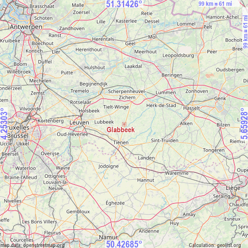
Glabbeek GPS coordinates[2]
50° 52' 21.612" North, 4° 57' 22.14" East
| Map corner | latitude | longitude |
|---|---|---|
| Upper-left | 51.31426°, | 4.25303° |
| Center: | 50.87267°, | 4.95615° |
| Lower-right: | 50.42685°, | 5.65928° |
| Map W x H: | 98.7×98.7 km | = 61.3×61.3mi |
| max Lat: | 51.46791° ⇑42.8% North |
| Glabbeek: | 50.87267° |
| min Lat: | ⇓57.2% South 49.53771° |
| min Long | Glabbeek | max Long |
| 2.59368° | 4.95615° | 6.25749° |
| W 64.1%⇐ | ⇒35.9% E |
Elevation
Elevation of Glabbeek is 50 m = 164 ft, and this is 49.5 m = 162 ft below average elevation for this country.
| Max E: |
582 m = 1909 ft | 49.8% |
| Avg. | 99.5 m = 326 ft | |
| Glabbeek | 50 m = 164 ft | |
Min E: |
1 m = 3 ft | 50.2% |
See also: Belgium elevation on elevation.city.
Geographical zone
Glabbeek is located in North temperate zone (between Tropic of Cancer and the Arctic Circle). Distance of this North polar circle is 1744.7 km =1084.1 mi to North.| Distance of | km | miles | from Glabbeek |
|---|---|---|---|
| North Pole | 4350.6 | 2703.3 | to North |
| Arctic Circle | 1744.7 | 1084.1 | to North |
| Tropic Cancer | 3050.6 | 1895.6 | to South |
| Equator | 5656.5 | 3514.8 | to South |


Nearby cities:
15 places around Glabbeek: (largest is in red/bold)
• Aarschot
15.2 km =9.4 mi,  326°
326°
• Bekkevoort
7.6 km =4.7 mi,  6°
6°
• Bierbeek
14.6 km =9.1 mi,  250°
250°
• Boutersem
9.5 km =5.9 mi,  243°
243°
• Diest
14.6 km =9.1 mi,  27°
27°
• Geetbets
11.2 km =7 mi,  77°
77°
• Halen
13.7 km =8.5 mi,  52°
52°
• Hoegaarden
11.8 km =7.3 mi,  203°
203°
• Holsbeek
14.9 km =9.3 mi,  291°
291°
• Kortenaken
8.3 km =5.2 mi,  61°
61°
• Landen
16 km =9.9 mi,  146°
146°
• Lubbeek
8.3 km =5.2 mi,  277°
277°
• Scherpenheuvel-Zichem
15.4 km =9.6 mi,  4°
4°
• Tienen
7.4 km =4.6 mi,  190°
190°
• Zoutleeuw
11.3 km =7 mi,  112°
112°
Sources, notices
• [Note1] Compared only with cities in Belgium existing in our database
• [Src1] Map data: © OpenStreetMap contributors (CC-BY-SA)
• [Src2] Other city data from geonames.org with taken over terms of usage.
• [Src3] Geographical zone / Annual Mean Temperature by Robert A. Rohde @ Wikipedia
