Salanso geodata
Salanso (Boucle du Mouhoun) is a seat of a second-order administrative division; located in Burkina Faso in Africa/Ouagadougou (GMT+0) time zone. With population of 10,385 people, there are 35 cities with bigger population in this country. Compared to other cities in Burkina Faso, 72.2% of cities are located further ↑North; 96.2% of cities are located further →East and 69.6% of cities have lower elevation than Salanso. Note1


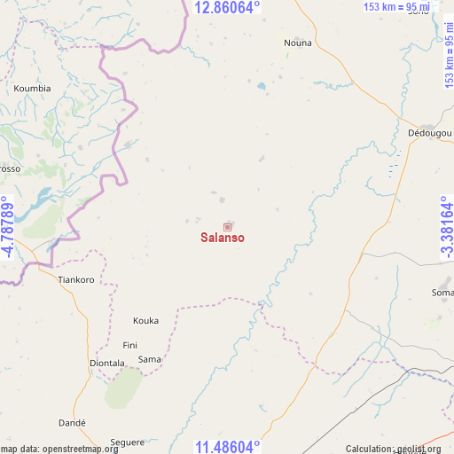
Salanso GPS coordinates[2]
12° 10' 27.228" North, 4° 5' 5.172" West
| Map corner | latitude | longitude |
|---|---|---|
| Upper-left | 12.86064°, | -4.78789° |
| Center: | 12.17423°, | -4.08477° |
| Lower-right: | 11.48604°, | -3.38164° |
| Map W x H: | 152.8×152.8 km | = 94.9×94.9mi |
| max Lat: | 14.96549° ⇑72.2% North |
| Salanso: | 12.17423° |
| min Lat: | ⇓27.8% South 9.88333° |
| min Long | Salanso | max Long |
| -5.16667° | -4.08477° | 1.78838° |
| W 3.8%⇐ | ⇒96.2% E |
Elevation
Elevation of Salanso is 316 m = 1037 ft, and this is 13 m = 43 ft above average elevation for this country.
| Max E: |
423 m = 1388 ft | 30.4% |
| Salanso | 316 m 1037 ft | |
| Avg. | 303 m = 994 ft | |
Min E: |
222 m = 728 ft | 69.6% |
See also: Burkina Faso elevation on elevation.city.
Geographical zone
Salanso is located in North Torrid zone (between Equator and Tropic of Cancer). Distance of this Northern Tropic circle is 1252.3 km =778.1 mi to North.| Distance of | km | miles | from Salanso |
|---|---|---|---|
| North Pole | 8653.4 | 5377 | to North |
| Arctic Circle | 6047.5 | 3757.7 | to North |
| Tropic Cancer | 1252.3 | 778.1 | to North |
| Equator | 1353.6 | 841.1 | to South |


Nearby cities:
15 places around Salanso: (largest is in red/bold)
• Banfora
186.8 km =116.1 mi,  203°
203°
• Barani
112.6 km =70 mi,  10°
10°
• Bobo-Dioulasso
113.3 km =70.4 mi,  191°
191°
• Boromo
134.3 km =83.5 mi,  110°
110°
• Dano
159.9 km =99.4 mi,  135°
135°
• Diébougou
162.6 km =101 mi,  145°
145°
• Dédougou
75 km =46.6 mi,  64°
64°
• Gousi
149.9 km =93.1 mi,  69°
69°
• Houndé
97.2 km =60.4 mi, 140°
• Koudougou
187.3 km =116.4 mi,  87°
87°
• Nouna
66.3 km =41.2 mi,  21°
21°
• Réo
176.1 km =109.4 mi,  84°
84°
• Sièn
141.1 km =87.7 mi, 65°
• Toma
144.2 km =89.6 mi, 63°
• Tougan
148.7 km =92.4 mi,  47°
47°
Sources, notices
• [Note1] Compared only with cities in Burkina Faso existing in our database
• [Src1] Map data: © OpenStreetMap contributors (CC-BY-SA)
• [Src2] Other city data from geonames.org with taken over terms of usage.
• [Src3] Geographical zone / Annual Mean Temperature by Robert A. Rohde @ Wikipedia
