Mani geodata
Mani (Est) is a seat of a third-order administrative division; located in Burkina Faso in Africa/Ouagadougou (GMT+0) time zone. In our database, there are 49 cities with bigger population. Compared to other cities in Burkina Faso, 86.1% of cities are located further ↓South; 86.1% of cities are located further ←West and 89.9% of cities have higher elevation than Mani. Note1


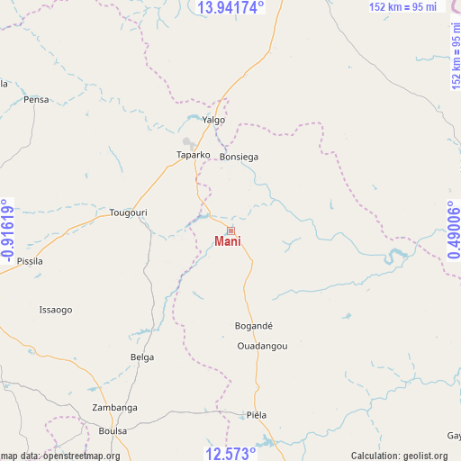
Mani GPS coordinates[2]
13° 15' 29.988" North, 0° 12' 47.016" West
| Map corner | latitude | longitude |
|---|---|---|
| Upper-left | 13.94174°, | -0.91619° |
| Center: | 13.25833°, | -0.21306° |
| Lower-right: | 12.573°, | 0.49006° |
| Map W x H: | 152.2×152.2 km | = 94.6×94.6mi |
| max Lat: | 14.96549° ⇑13.9% North |
| Mani: | 13.25833° |
| min Lat: | ⇓86.1% South 9.88333° |
| min Long | Mani | max Long |
| -5.16667° | -0.21306° | 1.78838° |
| W 86.1%⇐ | ⇒13.9% E |
Elevation
Elevation of Mani is 264 m = 866 ft, and this is 39 m = 128 ft below average elevation for this country.
| Max E: |
423 m = 1388 ft | 89.9% |
| Avg. | 303 m = 994 ft | |
| Mani | 264 m = 866 ft | |
Min E: |
222 m = 728 ft | 10.1% |
See also: Burkina Faso elevation on elevation.city.
Geographical zone
Mani is located in North Torrid zone (between Equator and Tropic of Cancer). Distance of this Northern Tropic circle is 1131.7 km =703.2 mi to North.| Distance of | km | miles | from Mani |
|---|---|---|---|
| North Pole | 8532.9 | 5302.1 | to North |
| Arctic Circle | 5927 | 3682.9 | to North |
| Tropic Cancer | 1131.7 | 703.2 | to North |
| Equator | 1474.2 | 916 | to South |


Nearby cities:
15 places around Mani: (largest is in red/bold)
• Absouya
114.1 km =70.9 mi,  233°
233°
• Bilanga
81.7 km =50.8 mi,  165°
165°
• Bogandé
32.7 km =20.3 mi, 167°
• Boulsa
76.6 km =47.6 mi,  210°
210°
• Boundoré
122.9 km =76.4 mi,  80°
80°
• Boussouma
101.7 km =63.2 mi,  247°
247°
• Dori
88.5 km =55 mi,  12°
12°
• Gayéri
102.3 km =63.6 mi,  131°
131°
• Kaya
96.1 km =59.7 mi,  258°
258°
• Korsimoro
104.3 km =64.8 mi,  242°
242°
• Koupéla
121 km =75.2 mi,  187°
187°
• Mané
126.1 km =78.4 mi, 256°
• Sebba
82.8 km =51.4 mi, 76°
• Zitenga
131.7 km =81.8 mi, 244°
• Zorgo
120.4 km =74.8 mi,  201°
201°
Sources, notices
• [Note1] Compared only with cities in Burkina Faso existing in our database
• [Src1] Map data: © OpenStreetMap contributors (CC-BY-SA)
• [Src2] Other city data from geonames.org with taken over terms of usage.
• [Src3] Geographical zone / Annual Mean Temperature by Robert A. Rohde @ Wikipedia
