Dori geodata
Dori (Sahel) is a seat of a first-order administrative division; located in Burkina Faso in Africa/Ouagadougou (GMT+0) time zone. With population of 37,806 people, there are 7 cities with bigger population in this country. Compared to other cities in Burkina Faso, 93.7% of cities are located further ↓South; 89.9% of cities are located further ←West and 78.5% of cities have higher elevation than Dori. Note1


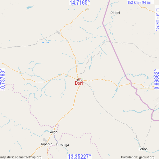
Dori GPS coordinates[2]
14° 2' 7.44" North, 0° 2' 4.2" West
| Map corner | latitude | longitude |
|---|---|---|
| Upper-left | 14.7165°, | -0.73763° |
| Center: | 14.0354°, | -0.0345° |
| Lower-right: | 13.35227°, | 0.66862° |
| Map W x H: | 151.7×151.7 km | = 94.3×94.3mi |
| max Lat: | 14.96549° ⇑6.3% North |
| Dori: | 14.0354° |
| min Lat: | ⇓93.7% South 9.88333° |
| min Long | Dori | max Long |
| -5.16667° | -0.0345° | 1.78838° |
| W 89.9%⇐ | ⇒10.1% E |
Elevation
Elevation of Dori is 282 m = 925 ft, and this is 21 m = 69 ft below average elevation for this country.
| Max E: |
423 m = 1388 ft | 78.5% |
| Avg. | 303 m = 994 ft | |
| Dori | 282 m = 925 ft | |
Min E: |
222 m = 728 ft | 21.5% |
See also: Burkina Faso elevation on elevation.city.
Geographical zone
Dori is located in North Torrid zone (between Equator and Tropic of Cancer). Distance of this Northern Tropic circle is 1045.3 km =649.5 mi to North.| Distance of | km | miles | from Dori |
|---|---|---|---|
| North Pole | 8446.5 | 5248.4 | to North |
| Arctic Circle | 5840.6 | 3629.2 | to North |
| Tropic Cancer | 1045.3 | 649.5 | to North |
| Equator | 1560.6 | 969.7 | to South |


Nearby cities:
15 places around Dori: (largest is in red/bold)
• Bilanga
165.6 km =102.9 mi,  179°
179°
• Bogandé
119.1 km =74 mi,  185°
185°
• Boulsa
163 km =101.3 mi,  201°
201°
• Boundoré
121.3 km =75.4 mi,  123°
123°
• Boussouma
168.7 km =104.8 mi,  222°
222°
• Djibo
171.7 km =106.7 mi,  272°
272°
• Déou
96.9 km =60.2 mi,  310°
310°
• Gayéri
164.5 km =102.2 mi,  159°
159°
• Gorom-Gorom
50.2 km =31.2 mi,  334°
334°
• Kaya
154.6 km =96.1 mi,  227°
227°
• Korsimoro
174.9 km =108.7 mi, 219°
• Mani
88.5 km =55 mi, 192°
• Oursi
84.7 km =52.6 mi, 327°
• Sebba
90.3 km =56.1 mi,  137°
137°
• Tin-Akoff
104.3 km =64.8 mi,  352°
352°
Sources, notices
• [Note1] Compared only with cities in Burkina Faso existing in our database
• [Src1] Map data: © OpenStreetMap contributors (CC-BY-SA)
• [Src2] Other city data from geonames.org with taken over terms of usage.
• [Src3] Geographical zone / Annual Mean Temperature by Robert A. Rohde @ Wikipedia
