Gayéri geodata
Gayéri (Est) is a seat of a second-order administrative division; located in Burkina Faso in Africa/Ouagadougou (GMT+0) time zone. With population of 1,958 people, there are 46 cities with bigger population in this country. Compared to other cities in Burkina Faso, 59.5% of cities are located further ↓South; 94.9% of cities are located further ←West and 79.7% of cities have higher elevation than Gayéri. Note1


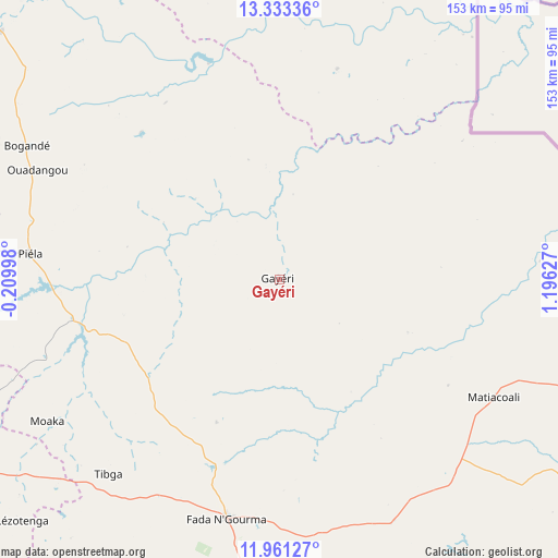
Gayéri GPS coordinates[2]
12° 38' 53.664" North, 0° 29' 35.304" East
| Map corner | latitude | longitude |
|---|---|---|
| Upper-left | 13.33336°, | -0.20998° |
| Center: | 12.64824°, | 0.49314° |
| Lower-right: | 11.96127°, | 1.19627° |
| Map W x H: | 152.6×152.6 km | = 94.8×94.8mi |
| max Lat: | 14.96549° ⇑40.5% North |
| Gayéri: | 12.64824° |
| min Lat: | ⇓59.5% South 9.88333° |
| min Long | Gayéri | max Long |
| -5.16667° | 0.49314° | 1.78838° |
| W 94.9%⇐ | ⇒5.1% E |
Elevation
Elevation of Gayéri is 281 m = 922 ft, and this is 22 m = 72 ft below average elevation for this country.
| Max E: |
423 m = 1388 ft | 79.7% |
| Avg. | 303 m = 994 ft | |
| Gayéri | 281 m = 922 ft | |
Min E: |
222 m = 728 ft | 20.3% |
See also: Burkina Faso elevation on elevation.city.
Geographical zone
Gayéri is located in North Torrid zone (between Equator and Tropic of Cancer). Distance of this Northern Tropic circle is 1199.6 km =745.4 mi to North.| Distance of | km | miles | from Gayéri |
|---|---|---|---|
| North Pole | 8600.7 | 5344.2 | to North |
| Arctic Circle | 5994.8 | 3725 | to North |
| Tropic Cancer | 1199.6 | 745.4 | to North |
| Equator | 1406.4 | 873.9 | to South |


Nearby cities:
15 places around Gayéri: (largest is in red/bold)
• Bilanga
57.3 km =35.6 mi,  258°
258°
• Bogandé
78.3 km =48.7 mi,  297°
297°
• Boulsa
115.9 km =72 mi,  271°
271°
• Boundoré
98.9 km =61.5 mi,  26°
26°
• Diapaga
154.5 km =96 mi,  114°
114°
• Dori
164.5 km =102.2 mi,  339°
339°
• Fada N'gourma
66.9 km =41.6 mi,  192°
192°
• Garango
147.5 km =91.7 mi,  230°
230°
• Koupéla
105.5 km =65.6 mi,  240°
240°
• Mani
102.3 km =63.6 mi,  311°
311°
• Ouargaye
135.9 km =84.4 mi,  200°
200°
• Pama
157.2 km =97.7 mi,  171°
171°
• Sebba
87.7 km =54.5 mi,  2°
2°
• Tenkodogo
134.6 km =83.6 mi,  224°
224°
• Zorgo
128.3 km =79.7 mi,  249°
249°
Sources, notices
• [Note1] Compared only with cities in Burkina Faso existing in our database
• [Src1] Map data: © OpenStreetMap contributors (CC-BY-SA)
• [Src2] Other city data from geonames.org with taken over terms of usage.
• [Src3] Geographical zone / Annual Mean Temperature by Robert A. Rohde @ Wikipedia
