Makamba geodata
Makamba is a seat of a first-order administrative division; located in Burundi in Africa/Bujumbura (GMT+2) time zone. With population of 19,642 people, there are 7 cities with bigger population in this country. Compared to other cities in Burundi, 100% of cities are located further ↑North; 60% of cities are located further ←West and 65% of cities have higher elevation than Makamba. Note1


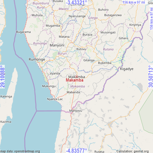
Makamba GPS coordinates[2]
4° 8' 5.28" South, 29° 48' 14.4" East
| Map corner | latitude | longitude |
|---|---|---|
| Upper-left | -3.43321°, | 29.10088° |
| Center: | -4.1348°, | 29.804° |
| Lower-right: | -4.83577°, | 30.50713° |
| Map W x H: | 156×156 km | = 96.9×96.9mi |
| max Lat: | -2.5845° ⇑100% North |
| Makamba: | -4.1348° |
| min Lat: | ⇓0% South -4.1348° |
| min Long | Makamba | max Long |
| 29.1248° | 29.804° | 30.5528° |
| W 60%⇐ | ⇒40% E |
Elevation
Elevation of Makamba is 1476 m = 4843 ft, and this is 35.4 m = 116 ft below average elevation for this country.
| Max E: |
2054 m = 6739 ft | 65% |
| Avg. | 1511.4 m = 4959 ft | |
| Makamba | 1476 m = 4843 ft | |
Min E: |
790 m = 2592 ft | 35% |
See also: Burundi elevation on elevation.city.
Geographical zone
Makamba is located in South Torrid zone (between Equator and Tropic of Capricorn). Distance of Equator is 459.7 km =285.6 mi to North.| Distance of | km | miles | from Makamba |
|---|---|---|---|
| Equator | 459.7 | 285.6 | to North |
| Tropic Capricorn | 2146.2 | 1333.6 | to South |
| Antarctic Circle | 6941.4 | 4313.2 | to South |
| South Pole | 9547.3 | 5932.4 | to South |


Nearby cities:
15 places around Makamba: (largest is in red/bold)
• Bubanza
125.9 km =78.2 mi,  338°
338°
• Bujumbura
97.1 km =60.3 mi,  329°
329°
• Bururi
28.7 km =17.8 mi,  316°
316°
• Cankuzo
131.5 km =81.7 mi,  39°
39°
• Gitega
79.8 km =49.6 mi,  9°
9°
• Isale
94.3 km =58.6 mi, 337°
• Karuzi
121.6 km =75.6 mi,  19°
19°
• Kayanza
136.2 km =84.6 mi,  351°
351°
• Manga
78.9 km =49 mi, 331°
• Muramvya
98.8 km =61.4 mi, 347°
• Muzinda
106 km =65.9 mi, 336°
• Mwaro
70.2 km =43.6 mi, 350°
• Rumonge
44.3 km =27.5 mi,  293°
293°
• Rutana
31 km =19.3 mi, 42°
• Ruyigi
88.3 km =54.9 mi,  33°
33°
Sources, notices
• [Note1] Compared only with cities in Burundi existing in our database
• [Src1] Map data: © OpenStreetMap contributors (CC-BY-SA)
• [Src2] Other city data from geonames.org with taken over terms of usage.
• [Src3] Geographical zone / Annual Mean Temperature by Robert A. Rohde @ Wikipedia
