Rutana geodata
Rutana is a seat of a first-order administrative division; located in Burundi in Africa/Bujumbura (GMT+2) time zone. With population of 20,893 people, there are 5 cities with bigger population in this country. Compared to other cities in Burundi, 85% of cities are located further ↑North; 75% of cities are located further ←West and 65% of cities have lower elevation than Rutana. Note1


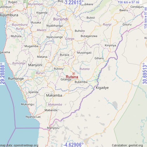
Rutana GPS coordinates[2]
3° 55' 40.44" South, 29° 59' 31.2" East
| Map corner | latitude | longitude |
|---|---|---|
| Upper-left | -3.22615°, | 29.28888° |
| Center: | -3.9279°, | 29.992° |
| Lower-right: | -4.62906°, | 30.69513° |
| Map W x H: | 156×156 km | = 96.9×96.9mi |
| max Lat: | -2.5845° ⇑85% North |
| Rutana: | -3.9279° |
| min Lat: | ⇓15% South -4.1348° |
| min Long | Rutana | max Long |
| 29.1248° | 29.992° | 30.5528° |
| W 75%⇐ | ⇒25% E |
Elevation
Elevation of Rutana is 1792 m = 5879 ft, and this is 280.6 m = 921 ft above average elevation for this country.
| Max E: |
2054 m = 6739 ft | 35% |
| Rutana | 1792 m 5879 ft | |
| Avg. | 1511.4 m = 4959 ft | |
Min E: |
790 m = 2592 ft | 65% |
See also: Burundi elevation on elevation.city.
Geographical zone
Rutana is located in South Torrid zone (between Equator and Tropic of Capricorn). Distance of Equator is 436.7 km =271.4 mi to North.| Distance of | km | miles | from Rutana |
|---|---|---|---|
| Equator | 436.7 | 271.4 | to North |
| Tropic Capricorn | 2169.2 | 1347.9 | to South |
| Antarctic Circle | 6964.4 | 4327.5 | to South |
| South Pole | 9570.3 | 5946.7 | to South |


Nearby cities:
15 places around Rutana: (largest is in red/bold)
• Bubanza
115.4 km =71.7 mi,  324°
324°
• Bujumbura
92.6 km =57.5 mi,  310°
310°
• Bururi
40.8 km =25.4 mi,  266°
266°
• Cankuzo
100.5 km =62.4 mi,  38°
38°
• Gitega
56.2 km =34.9 mi,  352°
352°
• Isale
85.6 km =53.2 mi, 318°
• Karuzi
93.8 km =58.3 mi,  11°
11°
• Makamba
31 km =19.3 mi,  222°
222°
• Manga
74.4 km =46.2 mi, 308°
• Muramvya
84.8 km =52.7 mi,  329°
329°
• Muzinda
97.5 km =60.6 mi, 319°
• Mwaro
56.3 km =35 mi, 325°
• Ngozi
114.9 km =71.4 mi, 351°
• Rumonge
61.6 km =38.3 mi, 265°
• Ruyigi
57.7 km =35.9 mi,  29°
29°
Sources, notices
• [Note1] Compared only with cities in Burundi existing in our database
• [Src1] Map data: © OpenStreetMap contributors (CC-BY-SA)
• [Src2] Other city data from geonames.org with taken over terms of usage.
• [Src3] Geographical zone / Annual Mean Temperature by Robert A. Rohde @ Wikipedia
