Mapiri geodata
Mapiri (La Paz) is a populated place; located in Bolivia in America/La_Paz (GMT-4) time zone. With population of 2,597 people, there are 91 cities with bigger population in this country. Compared to other cities in Bolivia, 91.9% of cities are located further ↓South; 91.3% of cities are located further →East and 65.2% of cities have higher elevation than Mapiri. Note1


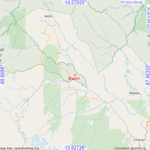
Mapiri GPS coordinates[2]
15° 15' 0" South, 68° 10' 0.012" West
| Map corner | latitude | longitude |
|---|---|---|
| Upper-left | -14.57055°, | -68.8698° |
| Center: | -15.25°, | -68.16667° |
| Lower-right: | -15.92726°, | -67.46355° |
| Map W x H: | 150.9×150.9 km | = 93.8×93.8mi |
| max Lat: | -9.71828° ⇑8.1% North |
| Mapiri: | -15.25° |
| min Lat: | ⇓91.9% South -22.73206° |
| min Long | Mapiri | max Long |
| -69.14843° | -68.16667° | -57.76667° |
| W 8.7%⇐ | ⇒91.3% E |
Elevation
Elevation of Mapiri is 806 m = 2644 ft, and this is 1205.3 m = 3954 ft below average elevation for this country.
| Max E: |
4732 m = 15525 ft | 65.2% |
| Avg. | 2011.3 m = 6599 ft | |
| Mapiri | 806 m = 2644 ft | |
Min E: |
92 m = 302 ft | 34.8% |
See also: Bolivia elevation on elevation.city.
Geographical zone
Mapiri is located in South Torrid zone (between Equator and Tropic of Capricorn). Distance of this Southern Tropic circle is 910.3 km =565.6 mi to South.| Distance of | km | miles | from Mapiri |
|---|---|---|---|
| Equator | 1695.6 | 1053.6 | to North |
| Tropic Capricorn | 910.3 | 565.6 | to South |
| Antarctic Circle | 5705.5 | 3545.2 | to South |
| South Pole | 8311.4 | 5164.5 | to South |


Nearby cities:
15 places around Mapiri: (largest is in red/bold)
• Achacachi
104.7 km =65.1 mi,  211°
211°
• Amarete
87.8 km =54.6 mi,  270°
270°
• Batallas
123.2 km =76.6 mi,  198°
198°
• Coripata
131.6 km =81.8 mi,  152°
152°
• Coroico
114.9 km =71.4 mi,  155°
155°
• Guanay
41 km =25.5 mi,  132°
132°
• Huarina
116.8 km =72.6 mi, 205°
• Huatajata
119.2 km =74.1 mi, 207°
• La Paz
139 km =86.4 mi,  179°
179°
• Reyes
138.7 km =86.2 mi,  40°
40°
• Rurrenabaque
113.1 km =70.3 mi, 37°
• San Pablo
129 km =80.2 mi, 213°
• San Pedro
131.9 km =82 mi, 213°
• Sorata
77.9 km =48.4 mi,  221°
221°
• Yumani
136.7 km =84.9 mi,  230°
230°
Sources, notices
• [Note1] Compared only with cities in Bolivia existing in our database
• [Src1] Map data: © OpenStreetMap contributors (CC-BY-SA)
• [Src2] Other city data from geonames.org with taken over terms of usage.
• [Src3] Geographical zone / Annual Mean Temperature by Robert A. Rohde @ Wikipedia
