Huachacalla geodata
Huachacalla (Oruro) is a seat of a second-order administrative division; located in Bolivia in America/La_Paz (GMT-4) time zone. In our database, there are 117 cities with bigger population. Compared to other cities in Bolivia, 64.6% of cities are located further ↑North; 91.9% of cities are located further →East and 85.1% of cities have lower elevation than Huachacalla. Note1


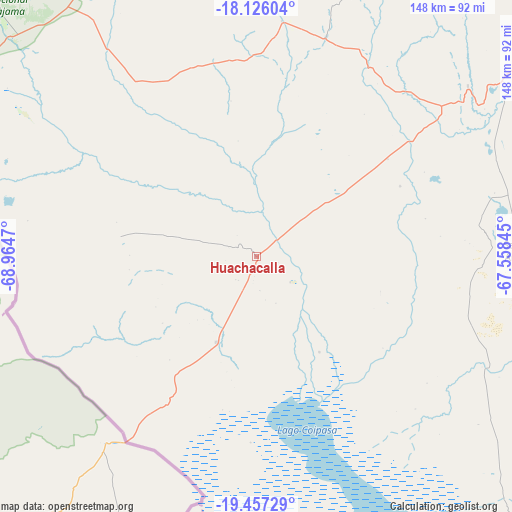
Huachacalla GPS coordinates[2]
18° 47' 34.728" South, 68° 15' 41.652" West
| Map corner | latitude | longitude |
|---|---|---|
| Upper-left | -18.12604°, | -68.9647° |
| Center: | -18.79298°, | -68.26157° |
| Lower-right: | -19.45729°, | -67.55845° |
| Map W x H: | 148×148 km | = 92×92mi |
| max Lat: | -9.71828° ⇑64.6% North |
| Huachacalla: | -18.79298° |
| min Lat: | ⇓35.4% South -22.73206° |
| min Long | Huachacalla | max Long |
| -69.14843° | -68.26157° | -57.76667° |
| W 8.1%⇐ | ⇒91.9% E |
Elevation
Elevation of Huachacalla is 3753 m = 12313 ft, and this is 1741.7 m = 5714 ft above average elevation for this country.
| Max E: |
4732 m = 15525 ft | 14.9% |
| Huachacalla | 3753 m 12313 ft | |
| Avg. | 2011.3 m = 6599 ft | |
Min E: |
92 m = 302 ft | 85.1% |
See also: Bolivia elevation on elevation.city.
Geographical zone
Huachacalla is located in South Torrid zone (between Equator and Tropic of Capricorn). Distance of this Southern Tropic circle is 516.3 km =320.8 mi to South.| Distance of | km | miles | from Huachacalla |
|---|---|---|---|
| Equator | 2089.6 | 1298.4 | to North |
| Tropic Capricorn | 516.3 | 320.8 | to South |
| Antarctic Circle | 5311.6 | 3300.5 | to South |
| South Pole | 7917.5 | 4919.7 | to South |


Nearby cities:
15 places around Huachacalla: (largest is in red/bold)
• Andamarca
79.4 km =49.3 mi,  88°
88°
• Belen
175.5 km =109.1 mi,  25°
25°
• Challapata
157.4 km =97.8 mi, 94°
• Colquiri
196.8 km =122.3 mi,  37°
37°
• Cruz de Machacamarca
19.5 km =12.1 mi,  238°
238°
• Curahuara de Carangas
104.6 km =65 mi,  350°
350°
• Eucaliptus
155.8 km =96.8 mi, 30°
• Huanuni
160.4 km =99.7 mi,  69°
69°
• Lahuachaca
169.9 km =105.6 mi,  21°
21°
• Llallagua
181.5 km =112.8 mi,  76°
76°
• Machacamarca
147.9 km =91.9 mi,  62°
62°
• Oruro
147.9 km =91.9 mi,  52°
52°
• Patacamaya
176.8 km =109.9 mi,  11°
11°
• Poopó
144 km =89.5 mi, 71°
• Totoral
149.9 km =93.1 mi, 77°
Sources, notices
• [Note1] Compared only with cities in Bolivia existing in our database
• [Src1] Map data: © OpenStreetMap contributors (CC-BY-SA)
• [Src2] Other city data from geonames.org with taken over terms of usage.
• [Src3] Geographical zone / Annual Mean Temperature by Robert A. Rohde @ Wikipedia
