Curahuara de Carangas geodata
Curahuara de Carangas (La Paz) is a populated place; located in Bolivia in America/La_Paz (GMT-4) time zone. With population of 1,613 people, there are 112 cities with bigger population in this country. Compared to other cities in Bolivia, 50.9% of cities are located further ↓South; 93.2% of cities are located further →East and 95.7% of cities have lower elevation than Curahuara de Carangas. Note1


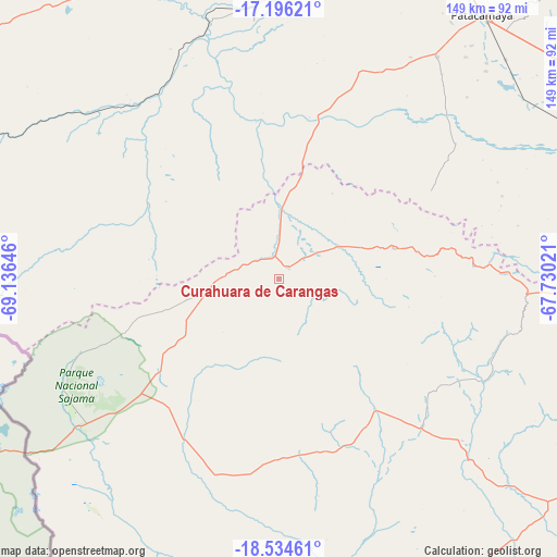
Curahuara de Carangas GPS coordinates[2]
17° 52' 0.012" South, 68° 25' 59.988" West
| Map corner | latitude | longitude |
|---|---|---|
| Upper-left | -17.19621°, | -69.13646° |
| Center: | -17.86667°, | -68.43333° |
| Lower-right: | -18.53461°, | -67.73021° |
| Map W x H: | 148.8×148.8 km | = 92.5×92.5mi |
| max Lat: | -9.71828° ⇑49.1% North |
| Curahuara de Carangas: | -17.86667° |
| min Lat: | ⇓50.9% South -22.73206° |
| min Long | Curahuara de Ca | max Long |
| -69.14843° | -68.43333° | -57.76667° |
| W 6.8%⇐ | ⇒93.2% E |
Elevation
Elevation of Curahuara de Carangas is 3945 m = 12943 ft, and this is 1933.7 m = 6344 ft above average elevation for this country.
| Max E: |
4732 m = 15525 ft | 4.3% |
| Curahuara de Carangas | 3945 m 12943 ft | |
| Avg. | 2011.3 m = 6599 ft | |
Min E: |
92 m = 302 ft | 95.7% |
See also: Bolivia elevation on elevation.city.
Geographical zone
Curahuara de Carangas is located in South Torrid zone (between Equator and Tropic of Capricorn). Distance of this Southern Tropic circle is 619.3 km =384.8 mi to South.| Distance of | km | miles | from Curahuara de Carangas |
|---|---|---|---|
| Equator | 1986.6 | 1234.4 | to North |
| Tropic Capricorn | 619.3 | 384.8 | to South |
| Antarctic Circle | 5414.6 | 3364.5 | to South |
| South Pole | 8020.5 | 4983.7 | to South |


Nearby cities:
15 places around Curahuara de Carangas: (largest is in red/bold)
• Andamarca
140.9 km =87.6 mi,  136°
136°
• Belen
108.9 km =67.7 mi,  59°
59°
• Colquiri
148.3 km =92.1 mi,  69°
69°
• Cruz de Machacamarca
113.1 km =70.3 mi,  179°
179°
• Eucaliptus
102.1 km =63.4 mi, 72°
• Huachacalla
104.6 km =65 mi,  170°
170°
• La Paz
154.9 km =96.3 mi,  11°
11°
• Lahuachaca
97.5 km =60.6 mi, 55°
• Machacamarca
153.2 km =95.2 mi,  102°
102°
• Oruro
136.4 km =84.8 mi, 95°
• Patacamaya
88.7 km =55.1 mi,  37°
37°
• Poopó
165.1 km =102.6 mi,  110°
110°
• Quime
162.2 km =100.8 mi,  52°
52°
• Tiahuanaco
148.5 km =92.3 mi,  349°
349°
• Viloco
138.5 km =86.1 mi, 42°
Sources, notices
• [Note1] Compared only with cities in Bolivia existing in our database
• [Src1] Map data: © OpenStreetMap contributors (CC-BY-SA)
• [Src2] Other city data from geonames.org with taken over terms of usage.
• [Src3] Geographical zone / Annual Mean Temperature by Robert A. Rohde @ Wikipedia
