Daga geodata
Daga (Dagana) is a seat of a first-order administrative division; located in Bhutan in Asia/Thimphu (GMT+6) time zone. With population of 2,243 people, there are 15 cities with bigger population in this country. Compared to other cities in Bhutan, 59.3% of cities are located further ↑North; 66.7% of cities are located further →East and 59.3% of cities have lower elevation than Daga. Note1


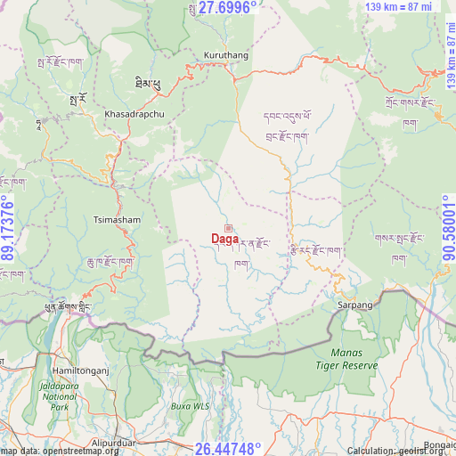
Daga GPS coordinates[2]
27° 4' 31.044" North, 89° 52' 36.768" East
| Map corner | latitude | longitude |
|---|---|---|
| Upper-left | 27.6996°, | 89.17376° |
| Center: | 27.07529°, | 89.87688° |
| Lower-right: | 26.44748°, | 90.58001° |
| Map W x H: | 139.2×139.2 km | = 86.5×86.5mi |
| max Lat: | 27.90372° ⇑59.3% North |
| Daga: | 27.07529° |
| min Lat: | ⇓40.7% South 26.78333° |
| min Long | Daga | max Long |
| 89.09951° | 89.87688° | 92.1° |
| W 33.3%⇐ | ⇒66.7% E |
Elevation
Elevation of Daga is 1558 m = 5112 ft, and this is 179.8 m = 590 ft above average elevation for this country.
| Max E: |
2761 m = 9058 ft | 40.7% |
| Daga | 1558 m 5112 ft | |
| Avg. | 1378.2 m = 4522 ft | |
Min E: |
145 m = 476 ft | 59.3% |
See also: Bhutan elevation on elevation.city.
Geographical zone
Daga is located in North temperate zone (between Tropic of Cancer and the Arctic Circle). Distance of this Northern Tropic circle is 404.6 km =251.4 mi to South.| Distance of | km | miles | from Daga |
|---|---|---|---|
| North Pole | 6996.6 | 4347.5 | to North |
| Arctic Circle | 4390.7 | 2728.3 | to North |
| Tropic Cancer | 404.6 | 251.4 | to South |
| Equator | 3010.5 | 1870.6 | to South |


Nearby cities:
15 places around Daga: (largest is in red/bold)
• Daphu
50.4 km =31.3 mi,  256°
256°
• Ha
68.4 km =42.5 mi,  300°
300°
• Lungtenzampa
49.4 km =30.7 mi,  332°
332°
• Pajo
50.9 km =31.6 mi,  0°
0°
• Paro
60.5 km =37.6 mi,  310°
310°
• Phuntsholing
54.4 km =33.8 mi,  242°
242°
• Punākha
57.4 km =35.7 mi, 0°
• Samtse
79.5 km =49.4 mi, 255°
• Sarpang
45.3 km =28.1 mi,  121°
121°
• Shemgang
78.9 km =49 mi,  78°
78°
• Thimphu
49.3 km =30.6 mi, 331°
• Trongsa
78.3 km =48.7 mi,  52°
52°
• Tsimasham
33.8 km =21 mi,  274°
274°
• Tsirang
25.1 km =15.6 mi,  103°
103°
• Wangdue Phodrang
45.7 km =28.4 mi, 2°
Sources, notices
• [Note1] Compared only with cities in Bhutan existing in our database
• [Src1] Map data: © OpenStreetMap contributors (CC-BY-SA)
• [Src2] Other city data from geonames.org with taken over terms of usage.
• [Src3] Geographical zone / Annual Mean Temperature by Robert A. Rohde @ Wikipedia
