Wangdue Phodrang geodata
Wangdue Phodrang (Wangdi Phodrang) is a seat of a first-order administrative division; located in Bhutan in Asia/Thimphu (GMT+6) time zone. With population of 7,507 people, there are 6 cities with bigger population in this country. Compared to other cities in Bhutan, 74.1% of cities are located further ↓South; 55.6% of cities are located further →East and 59.3% of cities have higher elevation than Wangdue Phodrang. Note1


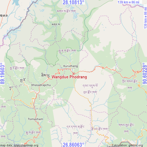
Wangdue Phodrang GPS coordinates[2]
27° 29' 10.14" North, 89° 53' 56.94" East
| Map corner | latitude | longitude |
|---|---|---|
| Upper-left | 28.10813°, | 89.19603° |
| Center: | 27.48615°, | 89.89915° |
| Lower-right: | 26.86063°, | 90.60228° |
| Map W x H: | 138.7×138.7 km | = 86.2×86.2mi |
| max Lat: | 27.90372° ⇑25.9% North |
| Wangdue Phodrang: | 27.48615° |
| min Lat: | ⇓74.1% South 26.78333° |
| min Long | Wangdue Phodran | max Long |
| 89.09951° | 89.89915° | 92.1° |
| W 44.4%⇐ | ⇒55.6% E |
Elevation
Elevation of Wangdue Phodrang is 1273 m = 4177 ft, and this is 105.2 m = 345 ft below average elevation for this country.
| Max E: |
2761 m = 9058 ft | 59.3% |
| Avg. | 1378.2 m = 4522 ft | |
| Wangdue Phodrang | 1273 m = 4177 ft | |
Min E: |
145 m = 476 ft | 40.7% |
See also: Bhutan elevation on elevation.city.
Geographical zone
Wangdue Phodrang is located in North temperate zone (between Tropic of Cancer and the Arctic Circle). Distance of this Northern Tropic circle is 450.3 km =279.8 mi to South.| Distance of | km | miles | from Wangdue Phodrang |
|---|---|---|---|
| North Pole | 6950.9 | 4319.1 | to North |
| Arctic Circle | 4345 | 2699.9 | to North |
| Tropic Cancer | 450.3 | 279.8 | to South |
| Equator | 3056.2 | 1899 | to South |


Nearby cities:
15 places around Wangdue Phodrang: (largest is in red/bold)
• Daga
45.7 km =28.4 mi,  182°
182°
• Daphu
77.1 km =47.9 mi,  221°
221°
• Gasa
49.4 km =30.7 mi,  339°
339°
• Ha
62 km =38.5 mi,  259°
259°
• Jakar
84.4 km =52.4 mi,  85°
85°
• Lungtenzampa
25.2 km =15.7 mi,  265°
265°
• Pajo
5.5 km =3.4 mi, 343°
• Paro
48.3 km =30 mi, 262°
• Punākha
11.9 km =7.4 mi,  349°
349°
• Sarpang
78.2 km =48.6 mi,  152°
152°
• Shemgang
80.7 km =50.1 mi,  111°
111°
• Thimphu
25.5 km =15.8 mi, 264°
• Trongsa
60 km =37.3 mi, 88°
• Tsimasham
56 km =34.8 mi, 219°
• Tsirang
56.2 km =34.9 mi,  156°
156°
Sources, notices
• [Note1] Compared only with cities in Bhutan existing in our database
• [Src1] Map data: © OpenStreetMap contributors (CC-BY-SA)
• [Src2] Other city data from geonames.org with taken over terms of usage.
• [Src3] Geographical zone / Annual Mean Temperature by Robert A. Rohde @ Wikipedia
