Sarpang geodata
Sarpang (Geylegphug) is a seat of a first-order administrative division; located in Bhutan in Asia/Thimphu (GMT+6) time zone. With population of 10,416 people, there are 5 cities with bigger population in this country. Compared to other cities in Bhutan, 85.2% of cities are located further ↑North; 51.9% of cities are located further ←West and 81.5% of cities have higher elevation than Sarpang. Note1


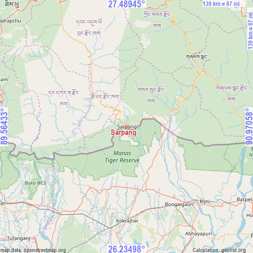
Sarpang GPS coordinates[2]
26° 51' 50.22" North, 90° 16' 2.82" East
| Map corner | latitude | longitude |
|---|---|---|
| Upper-left | 27.48945°, | 89.56433° |
| Center: | 26.86395°, | 90.26745° |
| Lower-right: | 26.23498°, | 90.97058° |
| Map W x H: | 139.5×139.5 km | = 86.7×86.7mi |
| max Lat: | 27.90372° ⇑85.2% North |
| Sarpang: | 26.86395° |
| min Lat: | ⇓14.8% South 26.78333° |
| min Long | Sarpang | max Long |
| 89.09951° | 90.26745° | 92.1° |
| W 51.9%⇐ | ⇒48.1% E |
Elevation
Elevation of Sarpang is 344 m = 1129 ft, and this is 1034.2 m = 3393 ft below average elevation for this country.
| Max E: |
2761 m = 9058 ft | 81.5% |
| Avg. | 1378.2 m = 4522 ft | |
| Sarpang | 344 m = 1129 ft | |
Min E: |
145 m = 476 ft | 18.5% |
See also: Bhutan elevation on elevation.city.
Geographical zone
Sarpang is located in North temperate zone (between Tropic of Cancer and the Arctic Circle). Distance of this Northern Tropic circle is 381.1 km =236.8 mi to South.| Distance of | km | miles | from Sarpang |
|---|---|---|---|
| North Pole | 7020.1 | 4362.1 | to North |
| Arctic Circle | 4414.2 | 2742.9 | to North |
| Tropic Cancer | 381.1 | 236.8 | to South |
| Equator | 2987 | 1856 | to South |


Nearby cities:
15 places around Sarpang: (largest is in red/bold)
• Daga
45.3 km =28.1 mi,  301°
301°
• Daphu
88.4 km =54.9 mi,  277°
277°
• Jakar
90 km =55.9 mi,  32°
32°
• Lungtenzampa
91.2 km =56.7 mi,  317°
317°
• Nganglam
97.9 km =60.8 mi,  95°
95°
• Pajo
83.6 km =51.9 mi,  332°
332°
• Panbang
71 km =44.1 mi,  89°
89°
• Phuntsholing
87.2 km =54.2 mi,  269°
269°
• Punākha
89.6 km =55.7 mi, 334°
• Shemgang
55.1 km =34.2 mi,  44°
44°
• Thimphu
91.2 km =56.7 mi, 317°
• Trongsa
74.9 km =46.5 mi,  18°
18°
• Tsimasham
77 km =47.8 mi,  289°
289°
• Tsirang
22.7 km =14.1 mi, 320°
• Wangdue Phodrang
78.2 km =48.6 mi, 332°
Sources, notices
• [Note1] Compared only with cities in Bhutan existing in our database
• [Src1] Map data: © OpenStreetMap contributors (CC-BY-SA)
• [Src2] Other city data from geonames.org with taken over terms of usage.
• [Src3] Geographical zone / Annual Mean Temperature by Robert A. Rohde @ Wikipedia
