Phuntsholing geodata
Phuntsholing (Chukha) is a populated place; located in Bhutan in Asia/Thimphu (GMT+6) time zone. With population of 17,043 people, there are 3 cities with bigger population in this country. Compared to other cities in Bhutan, 88.9% of cities are located further ↑North; 88.9% of cities are located further →East and 85.2% of cities have higher elevation than Phuntsholing. Note1


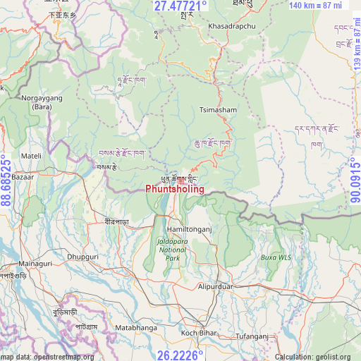
Phuntsholing GPS coordinates[2]
26° 51' 5.904" North, 89° 23' 18.132" East
| Map corner | latitude | longitude |
|---|---|---|
| Upper-left | 27.47721°, | 88.68525° |
| Center: | 26.85164°, | 89.38837° |
| Lower-right: | 26.2226°, | 90.0915° |
| Map W x H: | 139.5×139.5 km | = 86.7×86.7mi |
| max Lat: | 27.90372° ⇑88.9% North |
| Phuntsholing: | 26.85164° |
| min Lat: | ⇓11.1% South 26.78333° |
| min Long | Phuntsholing | max Long |
| 89.09951° | 89.38837° | 92.1° |
| W 11.1%⇐ | ⇒88.9% E |
Elevation
Elevation of Phuntsholing is 330 m = 1083 ft, and this is 1048.2 m = 3439 ft below average elevation for this country.
| Max E: |
2761 m = 9058 ft | 85.2% |
| Avg. | 1378.2 m = 4522 ft | |
| Phuntsholing | 330 m = 1083 ft | |
Min E: |
145 m = 476 ft | 14.8% |
See also: Bhutan elevation on elevation.city.
Geographical zone
Phuntsholing is located in North temperate zone (between Tropic of Cancer and the Arctic Circle). Distance of this Northern Tropic circle is 379.7 km =235.9 mi to South.| Distance of | km | miles | from Phuntsholing |
|---|---|---|---|
| North Pole | 7021.4 | 4362.9 | to North |
| Arctic Circle | 4415.6 | 2743.7 | to North |
| Tropic Cancer | 379.7 | 235.9 | to South |
| Equator | 2985.6 | 1855.2 | to South |


Nearby cities:
15 places around Phuntsholing: (largest is in red/bold)
• Daga
54.4 km =33.8 mi,  62°
62°
• Daphu
12.8 km =8 mi,  357°
357°
• Gasa
121.7 km =75.6 mi,  15°
15°
• Ha
60.5 km =37.6 mi,  349°
349°
• Lungtenzampa
73.1 km =45.4 mi, 20°
• Pajo
90.2 km =56 mi,  32°
32°
• Paro
64.4 km =40 mi,  2°
2°
• Punākha
95.4 km =59.3 mi, 30°
• Samtse
29.1 km =18.1 mi,  280°
280°
• Sarpang
87.2 km =54.2 mi,  89°
89°
• Shemgang
132.1 km =82.1 mi,  72°
72°
• Thimphu
72.8 km =45.2 mi, 20°
• Tsimasham
31.1 km =19.3 mi, 28°
• Tsirang
75.2 km =46.7 mi,  75°
75°
• Wangdue Phodrang
86.8 km =53.9 mi,  35°
35°
In other languages:
- In German: Phuentsholing
- In Italian: Phuentsholing
- In Russian: Пхунчолинг
- In Chinese: 彭措林
Sources, notices
• [Note1] Compared only with cities in Bhutan existing in our database
• [Src1] Map data: © OpenStreetMap contributors (CC-BY-SA)
• [Src2] Other city data from geonames.org with taken over terms of usage.
• [Src3] Geographical zone / Annual Mean Temperature by Robert A. Rohde @ Wikipedia
