Trongsa geodata
Trongsa (Tongsa) is a seat of a first-order administrative division; located in Bhutan in Asia/Thimphu (GMT+6) time zone. With population of 2,805 people, there are 14 cities with bigger population in this country. Compared to other cities in Bhutan, 77.8% of cities are located further ↓South; 55.6% of cities are located further ←West and 74.1% of cities have lower elevation than Trongsa. Note1


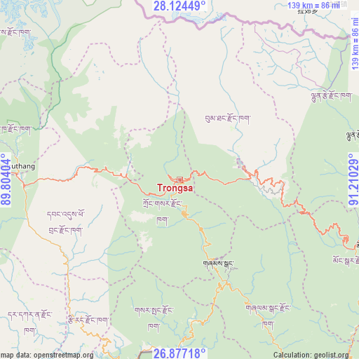
Trongsa GPS coordinates[2]
27° 30' 9.36" North, 90° 30' 25.776" East
| Map corner | latitude | longitude |
|---|---|---|
| Upper-left | 28.12449°, | 89.80404° |
| Center: | 27.5026°, | 90.50716° |
| Lower-right: | 26.87718°, | 91.21029° |
| Map W x H: | 138.7×138.7 km | = 86.2×86.2mi |
| max Lat: | 27.90372° ⇑22.2% North |
| Trongsa: | 27.5026° |
| min Lat: | ⇓77.8% South 26.78333° |
| min Long | Trongsa | max Long |
| 89.09951° | 90.50716° | 92.1° |
| W 55.6%⇐ | ⇒44.4% E |
Elevation
Elevation of Trongsa is 2108 m = 6916 ft, and this is 729.8 m = 2394 ft above average elevation for this country.
| Max E: |
2761 m = 9058 ft | 25.9% |
| Trongsa | 2108 m 6916 ft | |
| Avg. | 1378.2 m = 4522 ft | |
Min E: |
145 m = 476 ft | 74.1% |
See also: Bhutan elevation on elevation.city.
Geographical zone
Trongsa is located in North temperate zone (between Tropic of Cancer and the Arctic Circle). Distance of this Northern Tropic circle is 452.1 km =280.9 mi to South.| Distance of | km | miles | from Trongsa |
|---|---|---|---|
| North Pole | 6949.1 | 4318 | to North |
| Arctic Circle | 4343.2 | 2698.7 | to North |
| Tropic Cancer | 452.1 | 280.9 | to South |
| Equator | 3058 | 1900.2 | to South |


Nearby cities:
15 places around Trongsa: (largest is in red/bold)
• Daga
78.3 km =48.7 mi,  232°
232°
• Gasa
88.8 km =55.2 mi,  300°
300°
• Jakar
24.7 km =15.3 mi,  77°
77°
• Lhuentse
69.2 km =43 mi,  74°
74°
• Lungtenzampa
85.2 km =52.9 mi,  267°
267°
• Mongar
76.6 km =47.6 mi,  109°
109°
• Pajo
61.6 km =38.3 mi, 273°
• Panbang
85 km =52.8 mi,  146°
146°
• Punākha
62.9 km =39.1 mi,  279°
279°
• Sarpang
74.9 km =46.5 mi,  198°
198°
• Shemgang
35.1 km =21.8 mi, 154°
• Thimphu
85.4 km =53.1 mi, 267°
• Trashi Yangtse
98.4 km =61.1 mi, 82°
• Tsirang
65.6 km =40.8 mi,  215°
215°
• Wangdue Phodrang
60 km =37.3 mi, 268°
Sources, notices
• [Note1] Compared only with cities in Bhutan existing in our database
• [Src1] Map data: © OpenStreetMap contributors (CC-BY-SA)
• [Src2] Other city data from geonames.org with taken over terms of usage.
• [Src3] Geographical zone / Annual Mean Temperature by Robert A. Rohde @ Wikipedia
