Shemgang geodata
Shemgang is a seat of a first-order administrative division; located in Bhutan in Asia/Thimphu (GMT+6) time zone. With population of 852 people, there are 21 cities with bigger population in this country. Compared to other cities in Bhutan, 51.9% of cities are located further ↑North; 59.3% of cities are located further ←West and 70.4% of cities have lower elevation than Shemgang. Note1


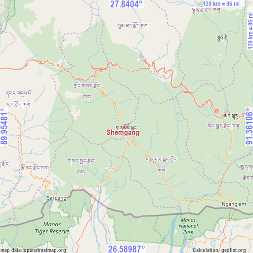
Shemgang GPS coordinates[2]
27° 13' 0.804" North, 90° 39' 28.548" East
| Map corner | latitude | longitude |
|---|---|---|
| Upper-left | 27.8404°, | 89.95481° |
| Center: | 27.21689°, | 90.65793° |
| Lower-right: | 26.58987°, | 91.36106° |
| Map W x H: | 139×139 km | = 86.4×86.4mi |
| max Lat: | 27.90372° ⇑51.9% North |
| Shemgang: | 27.21689° |
| min Lat: | ⇓48.1% South 26.78333° |
| min Long | Shemgang | max Long |
| 89.09951° | 90.65793° | 92.1° |
| W 59.3%⇐ | ⇒40.7% E |
Elevation
Elevation of Shemgang is 1900 m = 6234 ft, and this is 521.8 m = 1712 ft above average elevation for this country.
| Max E: |
2761 m = 9058 ft | 29.6% |
| Shemgang | 1900 m 6234 ft | |
| Avg. | 1378.2 m = 4522 ft | |
Min E: |
145 m = 476 ft | 70.4% |
See also: Bhutan elevation on elevation.city.
Geographical zone
Shemgang is located in North temperate zone (between Tropic of Cancer and the Arctic Circle). Distance of this Northern Tropic circle is 420.3 km =261.2 mi to South.| Distance of | km | miles | from Shemgang |
|---|---|---|---|
| North Pole | 6980.8 | 4337.7 | to North |
| Arctic Circle | 4374.9 | 2718.4 | to North |
| Tropic Cancer | 420.3 | 261.2 | to South |
| Equator | 3026.2 | 1880.4 | to South |


Nearby cities:
15 places around Shemgang: (largest is in red/bold)
• Daga
78.9 km =49 mi,  258°
258°
• Jakar
38.1 km =23.7 mi,  14°
14°
• Lhuentse
72.2 km =44.9 mi,  45°
45°
• Mongar
57.9 km =36 mi,  83°
83°
• Nganglam
75.9 km =47.2 mi,  129°
129°
• Pajo
84.2 km =52.3 mi,  294°
294°
• Panbang
50.5 km =31.4 mi,  140°
140°
• Pemagatshel
76.4 km =47.5 mi,  105°
105°
• Punākha
87.6 km =54.4 mi,  298°
298°
• Sarpang
55.1 km =34.2 mi,  224°
224°
• Trashi Yangtse
93.8 km =58.3 mi,  62°
62°
• Trashigang
89.5 km =55.6 mi, 81°
• Trongsa
35.1 km =21.8 mi,  334°
334°
• Tsirang
57.2 km =35.5 mi,  247°
247°
• Wangdue Phodrang
80.7 km =50.1 mi, 291°
Sources, notices
• [Note1] Compared only with cities in Bhutan existing in our database
• [Src1] Map data: © OpenStreetMap contributors (CC-BY-SA)
• [Src2] Other city data from geonames.org with taken over terms of usage.
• [Src3] Geographical zone / Annual Mean Temperature by Robert A. Rohde @ Wikipedia
