Inongo geodata
Inongo (Mai-Ndombe) is a seat of a first-order administrative division; located in Democratic Republic of the Congo in Africa/Kinshasa (GMT+1) time zone. With population of 40,113 people, there are 44 cities with bigger population in this country. Compared to other cities in Democratic Republic of the Congo, 64.3% of cities are located further ↓South; 78.6% of cities are located further →East and 88.6% of cities have higher elevation than Inongo. Note1


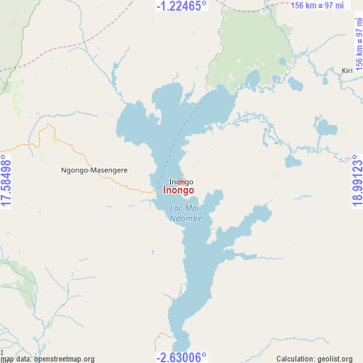
Inongo GPS coordinates[2]
1° 55' 39" South, 18° 17' 17.16" East
| Map corner | latitude | longitude |
|---|---|---|
| Upper-left | -1.22465°, | 17.58498° |
| Center: | -1.9275°, | 18.2881° |
| Lower-right: | -2.63006°, | 18.99123° |
| Map W x H: | 156.3×156.3 km | = 97.1×97.1mi |
| max Lat: | 4.279° ⇑35.7% North |
| Inongo: | -1.9275° |
| min Lat: | ⇓64.3% South -11.76097° |
| min Long | Inongo | max Long |
| 12.37148° | 18.2881° | 30.25224° |
| W 21.4%⇐ | ⇒78.6% E |
Elevation
Elevation of Inongo is 318 m = 1043 ft, and this is 338 m = 1109 ft below average elevation for this country.
| Max E: |
1996 m = 6549 ft | 88.6% |
| Avg. | 656 m = 2152 ft | |
| Inongo | 318 m = 1043 ft | |
Min E: |
11 m = 36 ft | 11.4% |
See also: Inongo elevation on elevation.city.
Geographical zone
Inongo is located in South Torrid zone (between Equator and Tropic of Capricorn). Distance of Equator is 214.3 km =133.2 mi to North.| Distance of | km | miles | from Inongo |
|---|---|---|---|
| Equator | 214.3 | 133.2 | to North |
| Tropic Capricorn | 2391.6 | 1486.1 | to South |
| Antarctic Circle | 7186.9 | 4465.7 | to South |
| South Pole | 9792.7 | 6084.9 | to South |


Nearby cities:
13 places around Inongo: (largest is in red/bold)
• Bandundu
184.5 km =114.6 mi,  213°
213°
• Boende
341.4 km =212.1 mi,  57°
57°
• Bolobo
229.9 km =142.9 mi,  263°
263°
• Bulungu
293.1 km =182.1 mi,  173°
173°
• Ilebo
369.5 km =229.6 mi,  136°
136°
• Kikwit
351.1 km =218.2 mi, 170°
• Kinshasa
424.6 km =263.8 mi,  231°
231°
• Lukolela
156.2 km =97.1 mi,  308°
308°
• Mangai
271 km =168.4 mi,  149°
149°
• Masina
421.9 km =262.2 mi, 229°
• Mbandaka
219.7 km =136.5 mi,  359°
359°
• Mushie
194.2 km =120.7 mi, 231°
• Nioki
110.4 km =68.6 mi,  217°
217°
Sources, notices
• [Note1] Compared only with cities in Democratic Republic of the Congo existing in our database
• [Src1] Map data: © OpenStreetMap contributors (CC-BY-SA)
• [Src2] Other city data from geonames.org with taken over terms of usage.
• [Src3] Geographical zone / Annual Mean Temperature by Robert A. Rohde @ Wikipedia
